4卷/3期

4卷/3期

華藝線上圖書館

Pages:

1-15

論文名稱

應用多時段衛星影像辨識水稻田之研究

Title

Automatic Recognition of Rice Fields From Multi-Temporal Satellite Images

作者

陳益凰 , 曾義星

Author

I-Huang Chen , Yi-Hsing Tseng

中文摘要

水稻是台灣地區的重要糧食作物,基於產量預估與災害補助依據所需,政府每年必須進行兩次水稻種植區域的調查。現行藉由航空像片搭配耕地坵塊圖,根據耕地坵塊所呈現之紋理以人工方式辨識該區塊是否為水稻田的做法相當耗費人力與時間。本研究嘗試結合耕地坵塊之地理資訊與多時段衛星遙測影像,利用各坵塊內之光譜植生指標隨時間的變化情形,以差分影像分類法 (Differenced Image Classification)、時間剖面匹配法 (Temporal Profile Matching) 與波峰偵測法 (Peak Detecting) 進行自動化水稻田辨識作業。實驗成果顯示結合地理資訊可大幅提高分類之精度,而多時段衛星影像的運用,不但可再提昇分類精度,而且不需要訓練資料,可以達到自動辨識的目的。

Abstract

Rice is the primary food crop in Taiwan. Rice inventory is therefore an important mission for the government to evaluate total rice production and provide a reference to subsidize economic loss caused by agricultural disasters. Currently, a photogrammetric surveying program manually interpreting aerial photos, is employed for the inventory work by the government. The procedures require a large amount of processing time and labor cost. In this research, a new approach to recognizing rice field automatically by integrating geographic information of land parcel and multi-spectral satellite images is proposed. Based on the fact that the vegetation coverage is changing during a rice season, the variation of the spectral properties and the resulting vegetation index provides the information to recognize rice fields. According to this idea, the methods proposed are Differenced-Image­Classification (DIC), Temporal-Profile-Matching (TPM), and Peak-Detecting (PD). In the case of using a single image epoch in paddy classification, the use of geographic information will largely improve the accuracy. When multi-temporal images are used, it can recognize rice fields easily without the need of training data and can further improve the accuracy.
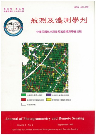
關鍵字

遙感探測、自動辨識、多時段衛星影像、水稻田

Keywords

Remote sensing, Automatic recognition, Multi-temporal satellite images, Rice fields

附件檔名

華芸線上圖書館

N / A

備註說明

199909-4-3-1-15

Pages:

17-30

論文名稱

多波段影像特徵分析於灘線萃取之研究

Title

Extraction of Shorelines from Multi-Spectral Images Using Feature Analysis

作者

陳良健 , 徐啟崇

Author

Liang-Chien Chen , Chii-Chorng Shyu

中文摘要

海岸之監測為國家發展及環境保育的重要工作。其中灘線之萃取更是最基本的工作項目。本研究目標即針對多波段衛星影像進行海岸線萃取。 本研究對於海岸線之萃取以 SPOT 為資料來源。提出之方法其主要概念為: (1) 經由影像分割的方式,先將影像區分為水陸二元圖,再經由邊界資訊萃取,來建立海岸線的近似位置; (2) 利用所建立海岸線之近似位置作為精確海岸線萃取之預估區間,在該區問內進行邊緣線之偵測及追蹤,以萃取出精確海岸線位置。 將所萃取的海岸線位置與 (1) 人工數化之成果進行比對,及 (2) 實際野外 GPS 量測海岸線位置做比對,以檢核萃取出海岸線位置之正確性。測試成果顯示海岸線萃取位置與人工數化成果相較,就差異之像元數而言為 2.48% 。與 GPS量測海岸線之間的差距在 1~2 像元間。

Abstract

Coastal zone monitoring is an important task in national development and environmental protection. In this the extraction of shorelines is a fundamental work. This investigation aims to extract shorelines in an automated way for optical images. SPOT multi-spectral imagery is the major data source in this investigation for shoreline extraction. The main components of extraction for shorelines include:(1) obtaining a rough separation between the land and water and (2) refining the rough land-water boundaries by edge detection and edge tracing algorithms to extract the accurate shoreline position. To assess the accuracy of shoreline position extracted automatically from the imagery, two validations are included: (1) the comparison of the extracted shorelines to the ones digitized by manual operation and (2) ground measurements by GPS were treated as references. The shoreline positions determined from the images were found to agree with (1) the manual digitization in 2.48% in terms of area, and (2) the ground measurements to within one to two pixels.

關鍵字

多波段影像、影像分割、灘線萃取

Keywords

Multi-spectral image, Segmentation, Shoreline extraction

附件檔名

華芸線上圖書館

N / A

備註說明

199909-4-3-17-30

Pages:

31-41

論文名稱

地面雙頻微波輻射計觀測濕遲延之空間變化

Title

Spatial Variation in Atmospheric Wet Delay Observed by a Ground-Based Dual-Channel Radiometer

作者

劉說安

Author

Yuei-An Liou

中文摘要

本研究應用水汽微波輻射儀 (Water Vapor Radiometer; WVR) 觀測大氣水汽對全球定位系統 (Global Positioning System; GPS) 訊號延遲之影響,該影響量即所謂濕遲延 (Wet Delay,WD)。首先,使用了民國七十七年到八十六年三月間在台北氣象站氣球探空觀測資料做分析,推導亮溫 (brightness temperature) 及光程估算濕遲延之迴歸公式。其次,於民國八十七年三月十八日到二十五日間在台北氣象站進行實驗,蒐集 23.8 及 31.4GHz 兩頻率的亮溫觀測,觀測時水平角設定在東西及南北走向兩方向轉換,仰角則設定在15゜及 165゜間,每 15゜做一次觀測。最後,分析 WVR 觀測資料,在天頂方向時,濕遲延變化範圍約介於晴天的 14.8cm 到陰雨天的 40.8cm 間。此外,成層化大氣之假設,隨著仰角偏離天頂方向而逐漸失真,在仰角165゜時誤差可達 8.3cm 。

Abstract

A ground-based water vapor radiometer (WVR) was utilized to investigate the inf1uence of water vapor on the propagation of Global Positioning System (GPS) signals through the atmosphere. The influence is in general characterized as so-called“wet delay" (WD). WD were inferred from brightness temperatures at 23.8 and 31.4GHz observed by WVR installed at Taipei weather station from March 18 to 25, 1998, and the corresponding opacity depths. During the field campaign, the WVR was initially installed due east while it was turned to north periodically. An elevation mirror is used to guide atmospheric emission to the antenna. It is designed to rotate perpendicularly to the WVR itself so that elevation angles can be automatically adjusted to scan the atmosphere every 15° at angles between 15° and 165°. In order to derive retrieval coefficients, radiosonde data collected at Taipei weather station in each March starting from 1988 to 1997 were used. WD from WVR measurements varies from 14.8cm for clear sky to 40.8cm for rainy/cloudy conditions at zenith. WD observations at angles from 15° to 165° indicate that stratified atmosphere becomes an less appropriate assumption with viewing angles departing from zenith. The deviation is increased to as much as 8.3cm at angle of 165° .

關鍵字

濕遲延、亮溫、光程

Keywords

Wet delay, Brightness temperature, Optical depth

附件檔名

華芸線上圖書館

N / A

備註說明

199909-4-3-31-41

Pages:

43-49

論文名稱

「科技短文」應用 SPOT 和 GMS-5 衛星資料估算大氣混濁度

Title

Enstimating Atmospheric Turbidity from SPOT and GMS-5 Data

作者

劉振榮 , 林唐煌 , 陳哲俊

Author

Gin-Rong Liu , Tang-Huang Lin , A. J. Chen

中文摘要

大氣混濁度不但是空氣污染的一個重要指標,也是影響遙測頻道的主要因素,特別是可見光頻道。由大氣分子與氣溶膠的散射作用,遙測資料將無法直接提供地表真正的訊息。但從另一觀點而言,既然受散射的影響,則遙測資料將隱含大氣混濁度的資訊。於是 Tanre 等人於 1988 年提出一結構函數法以求取大氣氣溶膠的光學厚度。研究結果顯示,在地表覆蓋物不變的前提下,利用多時的 Landsat TM 資料可獲得氣溶膠的光學厚度。由於台灣地區的地形較為複雜,本研究將改進結構函數法並應用於 SPOT 及 GMS-5 的衛星資料,以估算台灣地區大氣氣溶膠的光學厚度。研究結果顯示,經改進的結構函數法確有較佳之準確度,且其極高的可行性。未來將可進一步地應用於空氣品質及污染的偵測。

Abstract

The atmospheric turbidity is one very important factor in the air pollution measurements and monitoring with remotely sensed data, especially in visible bands. The scattering effects of atmospheric molecular and aerosols in varying atmospheric turbidity conditions can influent the original spectral information of remotely sensed data strongly. From another point of view, the atmospheric turbidity can be estimated by evaluating the information variation induced by the scattering effects. Tanre, et al., proposed the Structure Function (SF) to estimate the atmospheric optical depth in 1988. Their study result showed that the Aerosol Optical Depth (AOD) can be assessed with Landsat TM data by assuming the landcovers are same in the set of multi-temporal TM images. In this study, the SF method is improved for applying in Taiwan area because of the rather rough terrain and complex landuse properties. Besides, the higher spatial resolution SPOT data and hourly GMS-5 data were used to derive the AOD. The result shows the improvements in this study can get satisfying result, and it reveals we can derive these satellite data for the monitoring of hourly air pollution and air quality variation.

關鍵字

大氣混濁度、氣溶膠光學厚度、結構函數

Keywords

Atmospheric turbidity, Aerosol optical depth, Structure function

附件檔名

華芸線上圖書館

N / A

備註說明

199909-4-3-43-49

更多活動學刊