16卷/1期

16卷/1期

華藝線上圖書館

Pages:

1-10

論文名稱

以樹狀倒傳遞類神經網路於田埂判釋研究

Title

The Application on Improved-Tree Neural Network on Rice Image Classification

作者

萬絢, 雷祖強, 陳達祺

Author

Shiuan Wan , Tsu Chiang Lei, Da Chi Chen

中文摘要

台灣地區主要的糧食作物為水稻,因此政府每年都需耗費大筆經費與人力來估算水稻田的產量與面積。本研究採用QuickBird高解析度衛星影像搭配紋理資訊(Texture Information)和常態化差異植生指數(NDVI)作為影像分類時的輔助資訊,而分類器部份則使用倒傳遞類神經網路(Back Propagation Neural Network, BPNN)作為影像空間特徵分類器,其主要目的則是以自動判釋技術來分辨衛星影像中水稻田的區域,如此將有效的降低水稻田產量與面積的估算成本。然而過去的研究很少人討論水稻田分類時田埂判釋之問題,而水稻田埂為區隔出水稻與非水稻一個重要的地理界線,因此若能提高田埂判釋精度則水稻田坵塊特徵將會明顯的被區隔出來。因此本研究提出改良式樹狀多層邏輯判識方法,進而改善倒傳遞類神經網路對於田埂特徵的判釋成果,並以兩種不同的狀況分析作為說明案例:(1)案例a:利用倒傳遞類神經網路將光譜影像一次分為三類(水稻、非水稻以及田埂),(2)案例b:使用樹狀倒傳遞類神經網路的概念逐一分離出水稻、非水稻以及田埂的識別結果(以圖層的邏輯判識規則),兩者一起比較並探討其優缺點。研究結果顯示,本研究所提出之改良式樹狀多層邏輯判識方法,可提高分類器效能,進而解決了田埂判釋問題,而此方法也可大幅度改善坵塊面積的計算成果。

Abstract

Rice is one of the major corps of Taiwan. Accordingly, in the past, governments put great efforts on estimating the size of paddy rice. The objective of this study is to classify the area of paddy through satellite images by our spatial information system.In the present study, the material adopted is QuickBird satellite images. Owing to the low resolution of QuickBird satellite images, the texture information and NDVI were used as auxiliary material to enhance the quality of the images. On the other hands, leeve is one of the most important component to extract information on evaluating the area of paddy rice. Thus, it is decided to use two different cases to study the outcomes of extracting the leeves: Case (a) using BPN to classify the image into three category(paddy rice, leave, non-paddy rice) and Case (b)using Tree-Neural Network concept to step-by-step output the paddy rice, leave, non-paddy rice. The results are drawn and rational discussions are made.

關鍵字

影像分類、相對重要性、類神經網路

Keywords

image classification, Neural Networks, Tree-Neural Network

附件檔名

華芸線上圖書館

N / A

備註說明

201103-16-1-10

Pages:

11-22

論文名稱

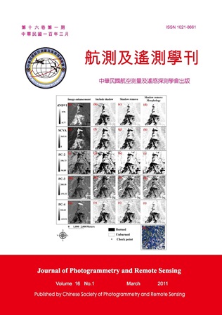
以變遷偵測技術探討高解析力數值航攝影像於森林火災自動製圖之應用

Title

Application On High Resolution Digital Aerial Images for Automatic Forest Fires Mapping by Change Detection Techniques

作者

謝依達, 鍾玉龍, 廖晟淞, 余曜光, 鄧國禎, 吳守從

Author

Yi- Ta Hsieh, Yuh- Lurng Chung, Chen-Sung Liao, Yau-Guang Yui, Kuo-Chen Teng, Shou-Tsung Wu

中文摘要

台灣全島面積一半以上為國有林地,若發生森林火災,往往造成生態環境之損害,因此快速的森林火災製圖,便成為一項十分重要之工作。本研究以2009年大埔事業區所發生的森林火災為研究對象,以Z/I DMC(Digital Mapping Camera)數值航攝影像為材料,探討火災區域自動化製圖之可行性。具體方式係採用NDVI影像差值法(NDVI differencing)、光譜變化向量分析法(spectral change vector analysis, SCVA)、主成份分析法(principal components analysis, PCA)三種變遷偵測技術,分別結合反覆自我組織分析技術(iterative self-organizing data analysis technique, ISODATA)非監督分類方法進行受災區域分類,除針對高解析航攝影像特性逐步去除雜訊外,並探討各偵測技術結合非監督分類之差異性,藉以建立高解析航攝影像於火災區位自動製圖之適當處理流程。研究結果顯示,各種影像增揚處理方式皆能有效突顯火災區域之特徵,然而搭配ISODATA非監督分類法,區分火災受災與非受災區域時,會受到增揚影像的數值分布所影響;在研究中,增揚影像的數值分布以單波峰偏斜分布,似乎較適合ISODATA區分兩類。經陰影濾除、形態學處理後皆可提升分類總體精確度,降低誤差。整體而言,以NDVI影像差值法搭配陰影去除、形態學後處理之精度最佳,總體精度達91.93%,且自動化程度高,本研究的森林火災自動製圖技術可供相關單位應用。

Abstract

In Taiwan, more than half of area is national forest land, if there was forest fire which often causes damage to the ecological environment. Therefore, rapid mapping of forest fires have become a very important job. We studied the forest fires of Dapu working cycle which was occurred in 2009, and we used Z/I DMC airborne multispectral image as material. In order to investigate the feasibility of automated forest fire mapping. We use three kinds of change detection techniques that include NDVI differencing (dNDVI), spectral change vector analysis (SCVA), principal components analysis (PCA), and we combined the three of change detection techniques and iterative self-organizing data analysis technique (ISODATA) to classify the fire affected area. We focused on the characteristics of high-resolution image to remove the noise of change detection, and to explore the differences between the three change detection techniques that combination ISODATA unsupervised classification. In order to establish the appropriate processes of automatic forest fires mapping for airborne multispectral image. The results showed that each change detection technique can enhance the characteristics of the fire area effective. However, those change detection techniques with ISODATA to distinguish between burned and unburned area, which will be affected by the distribution of enhanced image values. The numerical distribution of images to a single peak skewed distribution seems to be more suitable for two categories of classification using ISODATA. Image processing of shadow removal or morphology can reduce classification error and improve the overall classification accuracy. Overall, the dNDVI method with image processing of shadow removal and morphology showed the best overall accuracy of 91.93%, and with highly automated processes. The forest fire automatic mapping technology can provide the coherent units to be applied.
關鍵字

林火製圖、空載多光譜影像、變遷偵測、非監督分類

Keywords

forest fire mapping, airborne multispectral images, change detection, unsupervised classification.

附件檔名

華芸線上圖書館

N / A

備註說明

201103-16-11-22

Pages:

23-44

論文名稱

衛星雷達影像反投影定位與有理函數模式

Title

Satellite SAR imagery for image back projection and RFM

作者

施學延, 陳良健

Author

Hsueh-Yen Shih , Liang-Chien Chen

中文摘要

合成孔徑雷達影像使用微波獲取地表的資訊,因此具有全天候觀測和日夜皆可觀測的能力。為了提升雷達影像的應用,使校正過後的影像和其他地理資訊圖層的套合,並強化雷達影像在地理資訊系統的應用,雷達影像的幾何校正是必須的。傳統校正雷達衛星影像的做法是利用控制點,將雷達衛星軌道進行多項式平差。從直接地理對位的觀點出發,本文提出使用雷達影像反投影的方式進行雷達影像的校正,及簡化雷達影像的校正過程,並分析本研究方法的成效。由於有理函數模式標準化的處理流程,使得有理函數模式在光學影像上已經廣泛的使用,本研究也進行雷達影像有理函數模式的分析。 本研究的主要工作分成雷達影像反投影和雷達影像有理函數模式兩個部份。雷達影像反投影的工作項目分成建立雷達影像反投影程序、線性轉換、最小二配置和成果驗證。而雷達影像有理函數模式的工作項目分成建立有理函數模式、精化有理函數模式、最小二乘配置以及成果驗證。驗證部份測試不同的衛星資料並比較本研究提出的方法和PCI Geomatica Toutin模式進行成果的比較。成果顯示本研究提出的方法與PCI Geomatica Toutin模式相近或更佳。

Abstract

Synthetic Aperture Radars (SARs) take the advantages of all-weather and day-and-night capabilities to detect object information in microwave bands. In order to enhance the applications of SAR data, the geometric correction is a must. Thus, the generated ortho-image can be registered with other GIS data layers. The traditional methods for the rectification of SAR imagery adjust orbit polynomials according to ground control points. From direct georeferencing point of view, this paper investigates the feasibility of Radar back projection and analyzes the accuracy of proposed method to simplify the processing for SAR imagery rectification at first. Owing to the implementation and standardization of Rational Function Model (RFM), it is widely used in the optical sensor adjusting. This research also investigates the feasibility of RFM for radar images positioning. The major works includeradar back projection and RFM. The proposed scheme for radar back projection includes (1) establishing the Radar back projection procedure, (2) linear transformation, and (3) least squares collocation. In addition, the proposed scheme for RFM includes (1) establishment of RFM (2) refining, and (3) least squares collocation. The experiments test the images for different satellites and, then, compare the proposed method with the PCI Geomatica Toutin’s model. The proposed method can reach similar or ever better result than PCI Geomatica Toutin’s model.

關鍵字

雷達影像反投影、雷達有理函數模式、雷達幾何校正

Keywords

Radar Back Projection, Radar RFM, Radar Geometry Correction

附件檔名

華芸線上圖書館

N / A

備註說明

201103-16-23-44

Pages:

45-61

論文名稱

整合空間及遙測分析於非法廢棄物棄置場之判釋

Title

Application of Satellite Images for the Interpretation of Illegal Waste Dumping fields

作者

王瑞源, 徐逸祥, 陳依婕, 樊先達, 黃昭雄,朱子豪

Author

Ruei-Yuan Wang, Yi-Shiang Shiu , Yi-Chieh Chen, Shien-Ta Fan, Chao-Hsiung Huang, Tzu-How Chu

中文摘要

本研究旨在應用遙測技術監測台灣北部六個縣市,試圖有效的判釋出非法廢棄物的潛在棄置場區。研究方法係結合空間分析及遙測分析技術;空間分析係藉由歷年環保單位監測的異常案例,歸納與廢棄物傾倒之相關因子,以決策樹分類演算法(CART)進行資料探勘,推導廢棄物傾倒之空間規則,劃定潛在事件發生區域。遙測分析則針對可能棄置區之多期影像進行分類及植生指數變化分析,並進行光譜整合分析,以判釋影像的光譜變化情形;最後,篩選出重點監測區域,並進行實查驗證。分析結果:(一)空間資料探勘部分,擷取分析後的13條規則,並獲得可能棄置區規則6條,再運用ArcGIS進行環域分析,繪製出潛在棄置區的空間分佈圖。另由遙測光譜及空間分析而成功判釋出具有棄置物之場址計12處,正確率約達18.75%。(二)研究結果之意涵顯示,此模式可有助於強化環保單位的監測重點、節省監測成本及增強查報工作效率,並可運用於周全環保單位原有之環境監測網,建立全面性的環境監測。

Abstract

This study aims at applying remote sensing techniques to monitor the area of north Taiwan, that attempted to interpret the potential illegal waste dumping fields in an efficiently way. The research integrates spatial data mining analysis and remote sensing analysis. The former used the extraordinary cases of illegal waste dumping by the environmental protection unit over the years to generalize the factors of waste dumping, and using CART algorithm for data mining to produce the spatial rules of waste dumping that used for drawing the area of potential occurred event. The latter implements images classification and NDVI analysis focus on the potential dumping areas, and implementing integrated analysis of spectrum to interpret the changing of images. Finally, it obtains the results of monitoring areas for the checking and verifying on-the-spot. These research results as follows. (1)For the part of data mining, it comes out 13 rules, and acquires 6 rules of it of potential area. Then, these rules are implemented as buffer analysis through ArcGIS software to draw the spatial maps of potential waste dumping areas. After the integrated analysis of spectrum and spatial, 12 places has been verified and interpreted which were dumping fields. The results of successful rates could reach approximately 18.750%. (2) According to the research result indicated that remote sensing is an effective and useful tool for strengthening the monitoring mechanism, saving costs and enhancing the working efficiency for the environmental protection unit. Further, that could complete and improve the original system of environmental monitor in a way of comprehensiveness.

關鍵字

廢棄物、遙測、資料探勘、決策樹分類演算法

Keywords

Municipal Solid Wastes (MSW), Remote Sensing, Data Mining, Classification and Regression Trees (CART)

附件檔名

華芸線上圖書館

N / A

備註說明

20110316-46-61

Pages:

63-78

論文名稱

小林埋村事件之還原---衛星影像判釋

Title

Reconstruction of the Hsiaolin Village Catastrophe Using Methods of Satellite Image Interpretation

作者

潘國樑, 林彥享, 黃春銘, 柯傑夫, 鄭錦桐, 冀樹勇

Author

Kuo-Liang Pan , Yen-Hsiang Lin, Chuen-Ming Huang, Jeff Keck, Chin-Tung Cheng, Shu-Yeong Chi

中文摘要

民國98年8月9日因莫拉克颱風造成高雄小林村遭受土石流掩埋,從衛星影像的判釋結果得知,土石流係從同一個發源地,再分成兩股:北邊的一股為曲溝土石流,規模較小;南邊的一股為小林村土石流,規模約大4倍;而後者才是埋沒小林村的元凶。在發生時序上,小林土石流的運動過程可以分成三個時期:首先發生曲溝土石流;由於它對溝壁趾部的側蝕,引起順向坡滑動,曲溝乃被堵塞,曲溝土石流因而被阻斷;此為第二期。在進入第三期時,土石流改道,並且採直進方式,直沖小林村。如果將小林土石流的地形分區套疊在災前的衛星影像上時,可以發現其與原有地形非常吻合。由此證明,大規模地質災害大多在原地一再重現。因此利用衛星影像快速的檢出古土石流或古深層滑動,並且採取規避或棄離的措施,將可預防小林式埋村悲劇再度重演。

Abstract

The 2009 Typhoon Morakot caused a massive debris flow that buried Hsiaolin village and resulted in the death of hundreds of people. Satellite image interpretation reveals that the Hsiaolin debris flow originated in a single location and then split into two parts. The northern debris flow, the smaller of the two parts, flowed within a curve ravine. The southern part of the debris flow was four times larger than the northern part and responsible for the burial of Hsiaolin village. The movement of the debris flow can be divided into three processes. First a slope failure and subsequent debris flow occurred within a curve ravine. Second, the debris flow eroded the bank of the ravine laterally, causing translational failure of the ravine walls. A massive debris flow, made up of a combination of materials from both the original debris flow and the ravine walls, jammed within the ravine. Finally, as a result of the jam, the debris flow was redirected straightly towards the Hsiaolin village. Overlaying the zonation of the post Hsiaolin debris flow landforms on top of pre-failure satellite images reveals that characteristics of the post failure landforms match perfectly that observed in the pre-failure satellite images. This finding may support the thought that large scale geologic disasters are reoccurring. Satellite images can assist in identifying ancient debris flows and deep seated failures and if paired with hazard zoning and evacuation planning, disasters such as the Hsiaolin Village incident can be avoided.

關鍵字

小林村、土石流、遙測、影像判釋、災害原因、災害重建、深層滑動、 古土石流

Keywords

Hsiaolin Village、Debris Flow、Remote Sensing、Image Interpretation、Cause of Disaster、Disaster Recovery、Deep-Seated Landslide、Ancient Debris Flow

附件檔名

華芸線上圖書館

N / A

備註說明

201103-16-63-78

更多活動學刊