17卷/3期

17卷/3期

華藝線上圖書館

Pages:

特刊引言

論文名稱

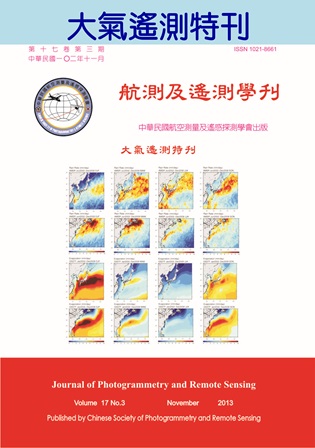
大氣遙測

Title

作者

劉振榮

Author

中文摘要

自美國第一顆氣象衛星 TIROS-1 於1960 年升空後,不但開創了衛星時代的新紀元,亦帶動衛星遙測的蓬勃發展。經過五十幾年的研究發展,不論是衛星本體或感測器之精度,以及遙測技術之提升均有重大的突破,且應用範圍與層級更勝以往。隨著觀測儀器與遙測技術的精進,衛星資料不但在整體天氣監測與預報中扮演相當重要角色,亦在全球高度關注之地球環境及氣候變遷議題下,提供大氣科學相關研究中不可或缺的參考資料。例如2013年IPCC最新公布的科學評估報告中(AR5),大氣觀測的重點資料,如全球的升溫、海平面高度、極端降雨、颱風強度變化及空氣污染等參數,均可藉由遙 測方式提供,並滿足全球性或區域性相關議題之完整解析與探討。而本特刊所刊載者便為其中大氣觀測之相關研究,包括颱風生成及強度預估、海氣能量的交互作用以及空氣污染(大氣氣膠)之反演等主題。除大氣的環境外,地表過程為影響天氣系統的重要因素之一,亦與空氣污染物的傳播擴散息息相關,所以土地利用型態的變異對於區域天氣影響之探討亦收納於本刊。 本刊論文主要呈現出航測及遙測技術在大氣參數反演和土地利用型態及其在天氣變化影響之解析與應用。第一篇和第三篇論文為颱風相關之研究,主要藉由衛星在環境場反演之熱力及動力參數,分別針對颱風生成前後之雲系進行特性之評估,並應用於西北太平洋熱帶氣旋生成之預報與颱風強度之估算。第二篇則利用衛星資料探討中低緯度黑潮與大氣間之交互作用,及其對大氣各項參數的影響,包括海面溫度、降雨率、水氣通量、風場輻合及熱通量等重要天氣因子,其季節性的變化亦於文中深入地探討。關於全球暖化的現象,人為活動的影響主要來自於溫室氣體的增溫效應,與大氣氣膠所造成的降溫效應。因此除溫室氣體的評估外,氣膠輻射驅動力之探討亦顯重要。本刊的第四篇論文即完整地論述衛星觀測在氣膠的吸收與散射能力之反演方法,期能提供更完整大氣氣膠之輻射特性,作為輻射驅動力相關研究之參考。而最後一篇論文則利用衛星觀測所更新之土地利用型態,探討其在區域氣象場之影響,並解析空氣污染的來源與傳送路徑,以利空氣污染的評估與掌握。綜合上述,本刊所收錄的五篇論文在大氣科學(遙測)的相關研究中實屬重要,對於全球暖化、氣候變遷及區域氣候等議題之解析,助益非淺且頗值參閱!

Abstract

關鍵字

Keywords

附件檔名

華芸線上圖書館

N / A

備註說明

N / A

Pages:

161-171

論文名稱

應用衛星反演熱力及動力參數以偵測熱帶氣旋 的生成---雲簇大小的自動化判定

Title

Using Satellite-Derived Thermal and Vorticity Parameters to Detect Tropical Cyclones Formation over the Northwest Pacific---Determination of Cloud Cluster Sizes

作者

曾千祐, 劉振榮

Author

Chang-Yo Tseng, Gin-Rong Liu

中文摘要

本研究將建立熱帶氣旋系統雲系大小之判定程序,以SSM/I及QuikSCAT衛星微波資料估算氣旋的熱力值與渦度值,以建立西北太平洋熱帶氣旋生成的熱力與渦度閾值。本研究選取2000年至2007年間5月至11月於西北太平洋形成之熱帶氣旋個案共106個,以其中2/3個案建立生成閾值,1/3個案進行相關驗証。驗証結果顯示,若未考慮系統大小變化(即固定範圍),35個驗証個案中有31個個案約可較JTWC提前兩天預測可能發展為熱帶氣旋的系統,可預報度為88.6%;若考慮系統雲系大小變化,則可預報度提昇為91.4%,顯示考慮系統大小可改善預報之成功率。而在2008年及2009年的24個獨立個案驗証方面,則有18個個案可成功提前預測,獲得相當不錯的結果,顯示在考量系統雲系範圍變化的情形,可有效改善熱帶氣旋生成預報之成功率。

Abstract

This study will use a dynamic computing coverage by considering the cluster size variation of the tropical cyclone system, and employ SSM/I and QuikSCAT satellite data to estimate the total heat energy and relative vorticity, respectively, in finding better thresholds for these two physical values as whether typhoons will occur or not in the Northwest Pacific. This study selects 106 tropical cyclone cases during May to November, 2000-2007 in the Northwest Pacific, two-thirds of these cases are used to establish the formation thresholds, one-thirds of these cases, which total to 35 cases, are regarded as dependant cases for verification. The result shows that if we used a fixed tropical cyclone system size, there were 31 cases can be announced almost two days earlier before the official JTWC warnings were issued. It reveals that the dynamic tropical cyclone system size could improve the prediction accuracy. Furthermore, the verification result of 24 independent cases during 2008-2009 shows that 18 cases could be predicted before JTWC. It could improve tropical cyclone prediction accuracy by considering the cluster size variation of tropical cyclone systems.

關鍵字

熱帶氣旋、熱力能量、相對渦度、颱風生成

Keywords

Tropical cyclone, Heat energy, Relative vorticity, Typhoon formation

附件檔名

華芸線上圖書館

N / A

備註說明

201311-17-161-171

Pages:

173-192

論文名稱

利用衛星資料分析台灣東部外海黑潮與大氣之交互作用

Title

Air-Sea Interaction of Kuroshio near the East of Taiwan by Satellite Remote Sensing

作者

方敏, 林依依, 隋中興

Author

Min Fang, I-I Lin, Chung-Hsing Sui

中文摘要

台灣緊鄰黑潮,眾多天氣系統與黑潮相關,近年針對中高緯度暖流與大氣間交互作用研究眾多,然而目前對中低緯度暖流,特別是台灣東部外海黑潮(由經緯度(127oE,30 oN), (132 oE,30 oN), (118 oE,22 oN), (123 oE,22 oN)四點組成之範圍)對大氣的影響程度了解甚少。本研究目的即為探討低緯段黑潮(KS)與大氣間交互作用,研究範圍定在台灣東部外海到琉球群島一帶,利用高解析衛星資料及觀測資料探討多項相關參數,包括海表面溫度、雲量、降雨率、蒸發率、水氣通量、風場輻合、垂直運動、熱通量等,分析季節性變化並搭配低緯段灣流(GS)比較討論。 季節分析結果顯示,KS區內冬季的黑潮藉可感熱通量和蒸發,對大氣影響為淺層加熱,然而受下沉氣流影響,垂直上升運動至750hPa;春季則透過海溫梯度(SST gradients)影響低層風場,風場和水氣在當地輻合,配合鋒面抬舉作用,產生對流以致降雨,垂直上升運動至400hPa;夏秋兩季對流發展強,分別達100hPa和150hPa,但是KS海溫梯度不顯著,主要為溫度夠高所致。較高緯度的GS則四季皆有顯著海溫梯度,冬季情形與KS類似,但無下沉氣流壓抑且和高緯運動相連,可達300hPa;春季蒸發減少1x10⁻²Pa/s,垂直運動只至700hPa;夏秋也和KS同,對流顯著達150hPa和200hPa,不過海溫梯度使上升運動固定於此。整體來說,若海表面溫度梯度夠顯著,且大尺度大氣無不利條件,例如強烈下沉氣流等因素,KS在冬季和春季時藉海溫梯度對低層風場的調整,影響可達中高對流層。

Abstract

Many weather phenomena are related to Kuroshio, which is neighboring to Taiwan. However, there were rare studies about the interaction between the atmosphere and the warm current in low latitude region, especially Kuroshio near the east of Taiwan ((127oE,30 oN), (132 oE,30 oN), (118 oE,22 oN), (123 oE,22 oN)). The aim of this study is to investigate the atmosphere response to the south region of Kuroshio (KS: 118-132oE, 22-30oN) and to compare with the south region of Gulf Stream (GS: 278-292oE, 30-38oN). A suit of high resolution satellite data and observed data are analyzed including sea surface temperature (SST), cloud, rain, evaporation, moisture flux, vertical motion and heat flux etc. Seasonal variability analysis showed that, in winter, KS and GS affected atmosphere by sensible heat flux and evaporation. The upward motion extended from surface to 300hPa in GS, but limited to 750hPa in KS owing to large scale downward motion; in spring, SST gradient was stronger than other seasons in KS and cooperated with frontal lifting. It sequentially caused the local wind convergence, deep convection and rain. The upward motion extended to 400hPa in KS, but to 700hPa in GS; in summer and fall, the upward motion extended to about 150hPa in both KS and GS. In GS, the SST gradient was the key to anchoring the upward motion. In KS, the deep convection was due to high-SST. Overall, the KS will affects the upper troposphere through low level wind adjustment by SST gradient in winter and spring, if SST is strong and atmospheric condition is not unfavorable. Our study was based on observed data set, the exact restricted reason and mechanism are not clear, other large scale information and regional model would be good methods to further study.
關鍵字

黑潮、海氣交互作用、海溫梯度、衛星資料

Keywords

Kuroshio; air-sea interaction; SST gradient; satellite data

附件檔名

華芸線上圖書館

N / A

備註說明

201311-17-173-192

Pages:

193-202

論文名稱

衛星影像邊緣偵測法在颱風強度估算之研究

Title

Typhoon Intensity Estimation Using Satellite Image Edge Detection Technology

作者

劉崇治, 陳良德

Author

Chung-Chih Liu, Liang-De Chen

中文摘要

颱風雲系結構和颱風強度有直接的關係,一般來說當颱風雲系結構密實,並且具有軸對稱的特徵時,颱風的中心最大風速常常較大,強度也越強。基於這個事實,本研究使用MTSAT_IR1 紅外線數據資料分析2008年辛樂克(Sinlaku)、薔密(Jangmi)與2011年桑達(Songda)強烈颱風的個案,並且利用邊緣偵測技術計算衛星影像的水平及垂直亮度溫度梯度,然後以颱風中心為參考點計算衛星影像中每一個像元的位置向量,然後將梯度向量與位置向量的角度差值定義為變異角度(Variantion Angle) ,最後分析此變異角度在颱風各個強度階段的分佈特性。研究結果顯示:MTSAT_IR1紅外線影像的變異角度分佈可以有效的反應出颱風強度,其與風速之相關係數大於0.7,因此衛星影像邊緣偵測技術在颱風強度估算的開發應用是可以期待的。

Abstract

There is a direct relationship between typhoon cloud structure and typhoon intensity. In general, when typhoon clouds with dense structure and the characteristics of axial symmetry, the typhoons are often strong. Based on this fact, the data used in this study was MTSAT_IR1 infrared data including Typhoon Sinlaku (2008), Typhoon Jangmi (2008) and Typhoon Songda (2011) cases. In addition, the satellite images edge detection technical was used to compute horizontal and vertical temperature gradient. Taking the typhoon center as a reference point for each satellite image pixel position vector, then the difference between gradient vector and the position vector was defined as the Variation Angle. Finally, the analysis of this variation angle for the various stages of the typhoon intensity was made. The results showed: MTSAT_IR1 infrared image of the angular distribution of variation can effectively respond to the introduction of wind strength, the correlation coefficient with wind speed greater than 0.7, so the satellite image edge detection technology in the development and application of typhoon intensity estimation is to be expected.

關鍵字

颱風強度 、邊緣偵測、衛星影像、影像處理

Keywords

Typhoon strength, Edge detection, Satellite imagery, Image processing

附件檔名

華芸線上圖書館

N / A

備註說明

201311-17-193-202

Pages:

203-220

論文名稱

結合MODIS與MISR觀測資料在氣膠單次散射反照率反演之應用

Title

Fusion of MODIS-MISR Data to Estimate Single Scattering Albedo for Different Aerosol Type

作者

李國揚, 連偉宏, 張國恩, 林唐煌

Author

Kuo-Yang Li, Wei-Hung Lien, Kuo-En Chang, Tang-Huang Lin

中文摘要

本研究主要目的是結合衛星資料與地面觀測資料反演單次散射反照率,並針對東南亞生質燃燒產生的煙塵與西非地區的沙塵探討不同氣膠種類的吸收及散射特性。主要的概念是使用一組同一地區時間相近的衛星影像,以乾淨大氣的地表反射特性作為參考基準,來反演受氣膠影響事件的單次散射反照率。研究結果顯示,當受氣膠影響事件的氣膠光學厚度高於0.5時,單次散射反照率反演的誤差可在3%以內,其中由生質燃燒產生的煙塵(泰國西北邊)單次散射反照率分別為0.88(藍光頻道)、0.84(紅光頻道)、0.84(近紅外光頻道),吸收特性相當明顯,而在泰國東南邊的單次散射反照率為0.94、0.91、0.88,吸收特性相對較弱,透過氣流軌跡的分析顯示,吸收特性之強弱主要與氣膠的來源地區有關。而非洲西部地區沙塵反演各頻道的單次散射反照率則分別為0.91、0.95、0.94,相對於生質燃燒具有較強的散射特性,但在夏季期間則具有較低值,由於該季節北風盛行,推估可能受到來自海洋地區吸收較強氣膠的影響,如海鹽等。整體研究結果顯示,不同地區氣膠吸收及散射特性可具有明顯的差異,主要與氣膠源區和盛行季風有關,而準確地計算氣膠吸收/散射的特性對於地球能量收支相關研究將有很大的助益。

Abstract

Global warming and climate change are the most important issues of the Earth system in the recent years. Atmospheric aerosols can have an important effect on the energy budget of Earth system, and different aerosol type usually exhibits different distinct radiometric characteristic in absorption and scattering. The low absorption leads to top of atmosphere cooling, such as dust, while heating can take place inside the atmosphere for strong absorption, such as smoke. Thus the absorption of aerosol is an important factor of energy balance which can influence in global warming and climate change. The present study intents to investigate the absorption of smoke plumes from Southeastern Asia bio-mass burning and the dust particles in West Africa by retrieving the single scattering albedo (SSA) from the fusion of satellite data and AERONET data. The concept of retrieving SSA is based on matching the surface reflectivity in multiple view angle retrieved on clear day. The results showed that when the aerosol optical depth is more than 0.5 on hazy day, the error of retrieving SSA can be less than 3%. The mean values of SSA retrievals in the northwestern Thailand are 0.88(blue band), 0.84(red band), 0.84(NIR band) and 0.94 0.91 0.88 in the southeastern Thailand, respectively. According to trajectory analysis, smoke plumes from different region could exhibit distinct optical properties. As for the dust particles, the mean values of retrieved SSA in the western Africa are 0.91, 0.95, and 0.94 in the blue, red, and NIR spectral bands, respectively. However, the SSA values are much lower in summer which may be polluted by the strong absorption of aerosols from ocean, such as sea salt. The results of this study imply that the absorptive property of aerosol mainly relates to the source region of aerosol types and the prevailing wind (monsoon), and the retrievals of absorptive property would be useful to the investigations regarding to the changes of Earth energy budget.

關鍵字

MOSID、MISR、AERONET、單次散射反照率、氣膠光學厚度

Keywords

MODIS, MISR, AERONET, Single Scattering Albedo (SSA), Aerosol Optical Depth (AOD)

附件檔名

華芸線上圖書館

N / A

備註說明

201311-17-203-220

Pages:

221-235

論文名稱

探討土地利用形態對珠江口沿岸地區氣象模擬的影響:高污染事件日之個案分析

Title

A numerical study to understand the effects of high resolution land use data on meteorological simulation results near Pearl River Delta: Application for a high ozone episode

作者

陳嘉華, 吳至翔, 鄭芳怡

Author

Ka-Wa Chan, Chih-Hsiang Wu, Fang-Yi Cheng

中文摘要

珠江三角洲位於中國華南沿岸,近年來由於經濟、工業與基礎建設的快速發展,當地的空氣品質與氣候的改變也倍受觀注。澳門屬於珠江三角洲沿海城市之一,人口密度位居世界城市排名之首。本研究使用中尺度氣象模式(WRF)模擬2007年10月24日至26日期間,高臭氧濃度事件日之氣象環境,並使用2007年MODIS衛星反演之土地利用型態資料,以更新及改善現有WRF氣象模式所提供之下邊界環境,進而探討事件日之成因。模擬結果顯示,珠江口附近沿岸地區由於盛行東北風與午後之海陸風在珠江口區域形成低風速帶,並由後推軌跡與粒子排放的分析,發現污染物主要的來源與午後低風帶的相關性。

Abstract

Pearl River Delta (PRD) is located in southern China near the coastline. Through the last two decades, PRD region has experienced the unprecedented land-use and land-cover changes as a result of rapid economic development and urban expansion. Its possible impact on regional air quality and climate change is a major concern of the national government as well as the global community. In this study, Weather Research and Forecasting (WRF) meteorological model is performed using the updated land use data for a high ozone event (October 24 to 26, 2007). The land use data is reclassified and updated using the 500-m resolution Moderate Resolution Imaging Spectroradiometer (MODIS) satellite products. Analysis of the wind field simulation result demonstrated that the see-breeze flow direction is opposite to the prevailing wind (1300 to 1800 LST) that forms a stagnant wind condition near the Macao and Pearl River Estuary region. The trajectory analysis showed that the ozone concentration was transported from the source area in the Guang-Dong province.

關鍵字

珠江三角洲、土地利用型態、海陸風

Keywords

Pearl River Delta, Land use type, Land-sea breeze

附件檔名

華芸線上圖書館

N / A

備註說明

201311-17-221-235

更多活動學刊