18卷/3期

18卷/3期

華藝線上圖書館

Pages:

特刊引言

論文名稱

海洋遙測

Title

作者

何宗儒

Author

中文摘要

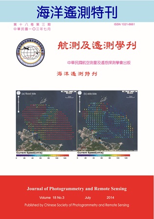
海洋占了地球表面積的70%以上,海洋的任何變化,對於地球環境有莫大的影響。但海洋因其遼闊,傳統上利用船舶或是浮標量測海洋的各種性質,常受限於經費、人力、安全等問題,要有效地定點、長期、全面取得觀測數據,並不容易。1978年美國航空暨太空總署(NASA)發射了Nimbus-7、NOAA-6、Seasat三顆與海洋觀測相關的人造衛星,分別利用可見光、紅外光及微波進行海洋遙測,觀測項目幾乎涵蓋所有的海洋的性質,從此為海洋觀測開啟新的一頁。隨者時代變遷,海洋研究已逐漸從大洋轉向近岸;而海洋遙測也開始從衛星遙測、航空遙測到岸基遙測,本特刊所刊載的論文即涵蓋各式的海洋遙測論述。「由測深光達反射率進行底質分類之研究」一文,即利用空載測深光達(Lidar),進行海底底質分類的研究。光達應用到海洋遙測研究,是一項嶄新的技術。該文以物件為基礎之分類方式,針對測深光達反射率進行底質分類,提供新的研究技術。「以MTSAT衛星影像分析臺灣海岸地區雲覆蓋率的時空特性」一文,則是利用傳統的地球同步氣象衛星,分析臺灣的雲覆蓋率。雲的產生與海洋習習相關,海洋研究,也常利用氣象衛星進行。該文以高斯混合模型及群集分析法,同時考慮時間與空間的雲覆蓋率的差異,成功分析臺灣海岸雲覆蓋率的差異。海洋內波是海洋研究中重要的議題之一,對漁業資源、海事工程及航海安全極為重要。「安達曼海的非線性內波」一文,是應用衛載合成孔徑雷達影像及可見光影像,分析邊緣海域的非線性內波,以了解其演化的過程。「陰陽海表面流場分析-影像特徵追蹤之應用」一文,乃利用架設於海岸邊的數位相機,對臺灣北部金瓜石附近的陰陽海進行潮汐週期的觀測,利用影像分析技巧,推估該海域表面流速。「從岸基X-band雷達回波監測近岸溫排水之初步研究」及「應用岸基微波雷達量測近岸海流空間分布」兩篇文章,則是利用設置在臺灣四周的岸基雷達,對臺灣近岸的電廠溫排水及近岸海流進行遙測。岸基雷達應用在海洋現象的遙測,也是在海洋觀測上新的技術。兩篇文章的結論,確認岸基雷達遙測,可做為近岸海洋觀測的利器。綜合上述,本刊所收錄的六篇論文,對於海洋表面、海洋內部甚至於海底的觀測,都展現出海洋遙測在海洋研究上的重要性,值得仔細閱讀。

Abstract

關鍵字

Keywords

附件檔名

華芸線上圖書館

N / A

備註說明

N / A

Pages:

145-152

論文名稱

由測深光達反射率進行底質分類之研究

Title

Substrate Classification with the Reflectivity of Bathymetric Lidar

作者

林暐尊, 史天元, 陳杰宗

Author

Wei-Tsun Lin, Tian-Yuan Shih, Jie-Chung Chen

中文摘要

測深光達(Bathymetric Lidar)以雷射掃描方式施測,由回波訊號之分析可了解雷射脈衝所歷經介質及界面等狀態, 除可獲取水深、水底地形資料外,亦能提供與底質種類相關資訊。本研究採用以物件為基礎(object-based)之分類方式針對AHAB Hawk Eye II系統之測深光達反射率進行底質分類。為增加分類時類別判釋依據,除反射率外,另計算反射率平均(mean)、方差(variance)、均質度(homogeneity)、相關性(correlation)、對比度(contrast)、差異度(dissimilarity)、熵(entropy)以及角二次矩(angular second moment)等紋理影像,將反射率及紋理影像共計9波段進行影像分割,分割後各區塊即為以物件為基礎之分類單位。由區塊中選取四個不同類別之訓練區,並以最鄰近法(nearest neighbor)將各物件分類。以分離度(separability)檢視分類成果,各類別之間Jeffries-Matusita距離最低值為1.710,大於一般認定達到明確分類之門檻值 。

Abstract

Bathymetric Lidar utilizes laser and scanning mechanism for measurement. From the recorded return signal of laser pulse, which is affected by both media and boundary between media layers, not only the water depth, but also the substrate information could be collected. This study explores the potential of substrate classification with reflectivity derived from AHAB Hawkeye II bathymetric lidar. Object-based classification scheme is adopted. Besides the reflectivity, eight GLCM based textures, namely, mean, variance, homogeneity, correlation, contrast, dissimilarity, entropy, and angular second moment are also computed. Image segmentation is applied for producing objects and then training areas of four classes are selected. The nearest neighbor classifier is applied for classifying the objects. The result is analyzed with Jeffries-Matusita distance, one index for measuring separability. It is shown that all J-M distances between the classes are larger than 1.710, which is larger than the threshold value of  .
關鍵字

紋理影像、分割、以物件為基礎分類、分離度

Keywords

Texture image, Segmentation, Object-based classification, Separability

附件檔名

華芸線上圖書館

N / A

備註說明

N / A

Pages:

153-160

論文名稱

以MTSAT衛星影像分析臺灣海岸地區雲覆蓋率的時空特性

Title

Spatial and Temporal Distribution of Cloud Coverage over Taiwan using MTSAT Satllite Images

作者

陳蔚瑋, 張憲國, 劉勁成

Author

Wei-Wei Chen, Hsien-Kuo Chang, Jin-Cheng Liou

中文摘要

本文以2009年至2012年四年的MTSAT衛星影像分析台灣的雲遮蓋率發現,在陸上區域的雲遮蓋率比在海上區域的高出19.5%,此結果異於往昔的海上雲量比陸上高23%的研究結論。另外比較各月份的雲覆蓋率發現, 7月份的海上與海岸地區雲覆蓋率為全年月份最低的,冬季的雲覆蓋則較夏季高,陸上區域的雲覆蓋率以4月至6月較其他月份高。一天自九時至下午四時的每小時的雲覆蓋率,以中午較高,而海上雲覆蓋率較海岸及陸上高。 本文再以高斯混合模型(GMM)及群集分析法,同時考慮時間與空間的雲覆蓋率的差異分類出台灣海岸成三群,其為高雲覆蓋率的東部海岸,雲覆蓋率較低且季節性變化較低的西南部與南部海岸,與介於兩者間的西部海岸段。本結果可提供欲以光學衛星影像進行海岸地區特性研究的可用率、以及應用至海岸生態、太陽能應用、農業養殖及國民居住環境等相關研究的參考。

Abstract

Using MTSAT stalellite images from 2009 to 2012 the spatial and temperal distribution of cloud coverage over Taiwan is investigated in this paper. More cloud coverage over lands than that over the sea by 19.5% in average is analyzed. The conclusion is different from the previous result indicating global cloud coverage over the sea exceeding that over land by 23%. Monthly averaged cloud coverage over the sea and coastal area in July is lowest among one year. Cloud coverage over three areas in the winter is higher than in the summer. Cloud coverage over land from April to June is generally higher than those in other months. Hourly variation of cloud coverage from am. 9 to pm 4 in a day shows that coverage in the noon exceeds those in other hours and that coverage over the sea exceeds that over land in a day.  Gaussian Mixture Model(GMM) and cluster analysis were applied to classifying three groups of cloud coverage over coastal area condersing spatial and temperal distribution. Eastern coast has the highest coverage among three groups; southern as well as southwestern coasts has the lowest one. The results can offer good references to help some researches in other fields, such as remote sensing in coastal area, marine ecology, aquaculture, agriculture and environment of residence.

關鍵字

衛星遙測、雲量分布、影像處理、群集分析

Keywords

Remote sensing, Cloud coverage, Image processing, Cluster analysis

附件檔名

華芸線上圖書館

N / A

備註說明

N / A

Pages:

161-173

論文名稱

安達曼海的非線性內波

Title

Nonlinear Internal Waves in the Andaman Sea

作者

許明光, 謝志宏, 何宗儒, 劉安國, 楊勁松

Author

Ming-Kuang Hsu, Chih-Hung Hsieh, Chung-Ru Ho, Antony K. Liu, Jingson Yang

中文摘要

亞洲邊緣海非線性內波非常活躍,蘇祿海(Sulu Sea)、南海(South China Sea) 及安達曼海(Andaman Sea)是其中非線性內波興盛且規模較大的幾個邊緣海。經過多年的研究,我們對蘇祿海及南海的內波已有相當的認識,然而對安達曼海內波的了解卻非常粗淺。規模較大的內波即使在解析度不高的衛星影像中也非常明顯,因此目前可用於研究規模較大內波的免費衛星影像資料非常多。本研究想由現有的免費衛星影像資料中,萃取安達曼海非線性內波的資訊,用於了解非線性內波在安達曼海的空間分布,源區及演化過程。本研究收集了數千餘幅安達曼海域的合成口徑雷達(Synthetic Aperture Radar, SAR)影像及MODIS(Moderate Resolution Imaging Spectroradiometer)等可見光影像。找出內波之波鋒線,彙整成一幅安達曼海的內波分布圖。根據個別的波群,找出安達曼海內波波源可能的位置。再根據內波波源及內波分布圖,來瞭解非線性內波在安達曼海的演化過程,並比較安達曼海內波與蘇祿海內波及南海內波相似與相異之處。

Abstract

Asian waters are abundant with nonlinear internal waves. Andaman Sea is one of the nonlinear internal wave active marginal seas. We like to know the spatial distribution of internal waves, the generation and evolution of internal waves in the Andaman Sea. Thus, we collected thousands of SAR images and MODIS images in Andaman Sea region. After compiler all of the images we collected, an internal wave distribution map of Andaman Sea was built up. Numerous of internal wave characters in Andaman Sea are identified such as internal wave sources, wave-wave interaction, wave reflection and internal waves generated in Andaman Sea but propagated outward into India Ocean are found and discussed.

關鍵字

安達曼海、內波、合成孔徑雷達、MODIS

Keywords

Andaman Sea、Internal wave,、SAR、MODIS

附件檔名

華芸線上圖書館

N / A

備註說明

N / A

Pages:

175-183

論文名稱

陰陽海表面流場分析-影像特徵追蹤之應用

Title

Analysis Of Surface Circulation In Yin-Yang Bay Using Digital Camera Imagery

作者

鄭志文, 謝坤成, 何宗儒, 趙彥豪

Author

Zheng-Wen Cheng, Kun-Cheng Hsieh, Chung-Ru Ho, Yan-Hao Chao

中文摘要

本研究旨在驗證應用數位相機拍攝之影像配合影像特徵追蹤法,推估台灣東北角海域陰陽海之表面流速之可行性。拍攝之影像必須經幾何轉換、影像平滑、邊緣偵測等影像前處理,方能進行後續之特徵位移判定。本文採用主觀目測與客觀最大交相關法(Maximum Cross Correlation)個別針對經由前述處理後之影像進行影像特徵位移之判定,以計算出兩不同方法推估之海面特徵之移動速度。經比較發現,由兩方法所推估之流速與前人實測的流速極為接近,因此證實利用數位相機針對特定區域進行長期流場觀測的可行性。此外,配合客觀最大交相關法的運用,整個流程將可全數自動化進行,可節省進行表面流場觀測時所需之人力與物力的花費。

Abstract

The purpose of this study is to verify the feasibility of using feature tracking method on the images taken by a digital camera near coastal areas. This technology is applied to the surface circulation in the Yin-Yang Bay, a small bay at northeastern Taiwan, with an obvious front of cloudy yellow fresh water and clear brine. The primary images taken in Yin-Yang Bay have to do geometric transformation, image smoothing, and edge detection before working on feature tracking. Two feature tracking methods are applied to these processed images for estimating surface current velocity. One is a subjective method of estimating distance among the sequence images by naked eyes and the other is an objective method of using Maximum Cross Correlation (MCC). The results show that the velocities of surface currents in the Yin-Yang Bay derived from both methods are similar and are comparable to the results of in-situ measurements. This indicates that the technology developed in this study is suitable for coastal circulation research.

關鍵字

遙測、數位相機、特徵追蹤法、表面流場、陰陽海

Keywords

Remote Sensing, Digital Camera, Feature Tracking Method, Surface Circulation, Yin-Yang Bay

附件檔名

華芸線上圖書館

N / A

備註說明

N / A

Pages:

185-192

論文名稱

從岸基X-band雷達回波監測近岸溫排水之初步研究

Title

Preliminary Study of Coastal Thermal Plume Oscillation Using X-band Radar Images

作者

吳立中, 莊士賢

Author

Li-Chung Wu, Laurence Zsu-Hsin Chuang

中文摘要

溫排水放流為臨海發電廠運作過程中之必要工作,為能掌握放流水對海洋環境之影響,實有賴於對溫排水放流結果之有效監控。本文提出利用岸基X-band雷達進行海面溫排水放流運動特徵偵測之初步研究結果。透過回波影像時序列的平均和無因次化,並以雷達電磁波之衰減效應進行修正等影像處理工作,將海面的特定回波特徵予以強化。經由現場觀測之海水溫度、潮汐及海流資料與雷達回波特徵之交互比對,證實了從電廠排水口延伸出的帶狀雷達回波特徵與溫排水時空分布之關聯性,也初步確認了岸基X-band雷達應用於監測近岸溫排水運動特徵之可行性。

Abstract

This study discusses the detection of thermal plume using X-band radar images. After a series of image processing, we can detect an obvious echo band pattern at the drain outlet of a coastal power plant. We confirm this echo band pattern is induced by the thermal plume after comparing with the simultaneous in-situ sea surface temperature records. We also reveal that the plume pattern is oscillated due to the influence of tidal current. Although the X-band radar image cannot provide the water temperature information within the plume, we can obtain the spatio-temporal features of the thermal plume which is useful for coastal management and environmental protection.

關鍵字

X-band雷達、影像處理、溫排水放流偵測

Keywords

X-band radar, Image processing, Thermal plume

附件檔名

華芸線上圖書館

N / A

備註說明

N / A

Pages:

193-204

論文名稱

應用岸基微波雷達量測近岸海流空間分布

Title

Observation of Nearshore Current by Using Land-based Microwave Radar

作者

董東璟, 蔡政翰, 陳盈智, 顏志偉, 馬名軍

Author

Dong-Jiing Doong, Cheng-Han Tsai, Ying-Chih Chen, Chih-Wei Yen, Ming-Jiun Maa

中文摘要

航海用微波雷達已被使用來作為海流觀測的工具,但大部分的研究是計算雷達掃射範圍內的平均海流,這對於近岸高度非均勻(non-homogeneous)海域並不合適。本文應用頻散關係(dispersion relation)對雷達海面回波進行濾波,疊代計算出表面海流結果,建立了以微波雷達分析近岸空間流場之架構,並以現場實測資料驗證了從雷達回波分析表面流場結果之準確性。本研究分別在新北市富貴角海域和基隆市海洋大學前方基隆嶼海域進行觀測研究,結果顯示,在富貴角離岸2公里外的海域開始,其平均流速有超過70%時間大於1m/s,觀測期間最大達 3.92m/s,是潮流發電的理想場址。本文也觀測到富貴角西側海岸偶有離岸裂流(rip current)出現,對海域活動者帶來潛在危害。基隆海域的觀測結果顯示,在乾潮前後一小時內,基隆嶼東南方海面會出現一個半徑約一公里的逆時針渦漩。本文研究除驗證了微波雷達觀測近岸海流的準確性外,也提出了近岸空間海流變化在海洋能源開發、防災、環保與科學研究上應用的具體實例。

Abstract

Microwave radar has been applied for nearshore current measurement. But most of them are implemented by a representative current from a whole image which is not reasonable for nearshore area. The purpose of this study is going to derive the spatial current distribution according to image spectral filter method based on dispersion relation. This study measured current at Fuguei Cape and Keelung sea area by microwave radar, and compared with Acoustic Doppler Current Profiler (ADCP) to verify the accuracy. The results confirm the reliance and correctness of current data form radar. The observation from Fuguei Cape found that the averaged current speed is higher than 1 m/s far from 2 km offshore area. The max. current speed observed is 3.92 m/s at Fuguei Cape coast. A strong flow and rip current were found in the east side of the Fuguei Cape and within the bay. They may cause by the interaction between tidal and coastal topography. The observation from Keelung sea area found a counterclockwise vortex one hour before and after low tide with one kilometer radius which occurs in the south-east of Keelung Sill. The strongest speed (1.55 m/s) occurs at 1.5km from Keelung sill with depth of 20 m.

關鍵字

微波雷達、空間海流分布、裂流、潮流發電、渦漩

Keywords

Microwave radar, Spatial current distribution, Rip current, Tidal current power, Eddy

附件檔名

華芸線上圖書館

N / A

備註說明

N / A

更多活動學刊