25卷/1期

25卷/1期

華藝線上圖書館

Pages:

1-10

論文名稱

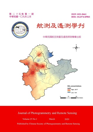
利用地理加權迴歸進行台北都會區二氧化氮之模擬分析

Title

Estimation of NO_2 Variability in Taipei Metropolis Using Geographically Weighted Regression

作者

翁佩詒、吳治達、蘇慧貞

Author

Pei-Yi Wong, Chih-Da Wu, Huey-Jen Su

中文摘要

二氧化氮(NO_2)為都會區最重要的空氣污染物之一。本研究以台北都會區為研究區,結合環境保護署18個監測站於2000年至2013年月平均空污濃度監測資料、以及土地利用的GIS資料,利用地理加權迴歸(Geographically Weighted Regression, GWR)推估NO_2的時空變異。結果指出,研究期間台北都會區的NO_2濃度呈現逐漸下降的趨勢,由2000年的25.94ppb減少為2013年的21.48ppb;模型分析結果指出,道路與污染具正相關,森林、水體與污染則呈負相關;所建模型之R^2達0.89,具有高度之預測與解釋力。最後利用所建模型推估台北都會區NO_2濃度之空間變異,結果顯示,污染物濃度較高的地區主要集中在台北市以及新北市人口稠密、道路交通發達之地區。

Abstract

Nitrogen Dioxide (NO_2) is one of the major air pollutants in urban area. In this study, NO_2 concentration observations during 2000 to 2013 were obtained from 18 EPA monitoring stations. Geographically Weighted Regression (GWR) coupled with GIS land-use data was then applied to assess the spatial-temporal variability of NO_2 in Taipei metropolis. The results showed that, a slightly decreasing trend was found in the pollutant level during the studied fourteen years. For example, the averaged NO_2 concentration level was 25.49ppb in 2000 but decreased to 21.48ppb in 2013. Several land-use related variables were selected as important predictors in the developed GWR model. Among them, roads were positively corelated to pollutant levels. Forests and waterbodies showed a negative association. Moreover, the resultant model had a highly explanatory power with the model R^2 of 0.89. Finally, NO_2 variability was illustrated using the developed model. Higher pollutant levels were clustered in the densely populated areas with heavy traffic.

關鍵字

空氣污染、二氧化氮、土地利用、地理加權迴歸

Keywords

Air pollution, Nitrogen Dioxide (NO2), Land-use, Geographically Weighted Regression (GWR)

附件檔名

華芸線上圖書館

https://www.airitilibrary.com/Publication/Index?DocID=10218661-202003-202003270003-202003270003-1-10

備註說明

N / A

Pages:

11-23

論文名稱

應用克利金/土地利用迴歸混合模式推估林園臨海石化工業區懸浮微粒之時空分布

Title

Estimate Particulate Matter Concentrations Variations in a Petrochemical Parks Area Using a Hybrid Kriging / Land-Use Regression Model

作者

吳昭儀、吳治達、陳裕政、許金玉、陳穆貞

Author

Jhao-Yi Wu, Chih-Da Wu, Yu-Cheng Chen, Chin-Yu Hsu, Mu-Jean Chen

中文摘要

石化工業為一大型污染來源,了解石化工業區周遭污染濃度之時空變化有其必要性。本研究以林園臨海工業區之懸浮微粒污染為研究標的,藉由傳統土地利用迴歸與克利金/土地利用迴歸混合模式進行建模。其中傳統土地利用迴歸模式R^2、ADJ-R^2和RMSE分別為0.89、0.89以及7.29μg/m^3,交叉驗證結果R^2、ADJ-R^2和RMSE分別為0.83、0.83及9.02μg/m^3;而克利金/土地利用迴歸混合模式建立之結果,模式R^2、ADJ-R^2和RMSE分別為0.95、0.95以及5.2μg/m^3,交叉驗證結果R^2、ADJ-R^2和RMSE分別為0.94、0.94及5.41μg/m^3。相較之下,混合模式提升了約6%的解釋能力,其表現優於傳統模式。由所建之混合式模型推估林園臨海工業區PM_(10)濃度之時空分布發現,由空間部分觀察到住宅區、水稻田及製造業區域其PM_(10)濃度較高;時間部分則為2015-2017年濃度漸高,到了2018年呈下降趨勢。

Abstract

The petrochemical industry is a major contributor to air pollution emissions, so determining the variations of these pollutants in the petrochemical industrial area is needed to reduce health risks due to PM_(10) exposures. In this study, a specific industrial monitoring database was used to collect PM_(10) data from May 2015 to September 2018 in Kaohsiung Petrochemical Parks area (including Linyuan Industrial Park and Linhai Industrial Park), Taiwan. Conventional land use regression and hybrid kriging approach which consider both the spatial and temporal heterogeneity of air pollutants was then conducted to develop the prediction model for estimating the spatial-temporal variability of PM_(10) concentrations. The resultant models showed a high-estimate performance level with the value of R^2, Adjusted R^2, RMSE and cross-validation for conventional approach was 0.89, 0.89, 7.29 μg/m^3 and 0.83, 0.83, 9.0 μg/m^3, respectively; and for hybrid approach was 0.95, 0.95, 5.2 μg/m^3 and 0.94, 0.94, 5.41 μg/m^3, respectively. The hybrid approach showed better explanatory power than conventional approach. Moreover, the results of hybrid model simulation showed that the highest concentrations of PM_(10) formed in the pure residential area, the manufacturing areas and agricultural fields; a similar decreasing trend was observed as well.
關鍵字

懸浮微粒、克利金/土地利用迴歸混合模式、石化工業區

Keywords

Particulate Matter, Hybrid Kriging /Land-Use Regression Model, Petrochemical Industrial Area

附件檔名

華芸線上圖書館

https://www.airitilibrary.com/Publication/Index?DocID=10218661-202003-202003270003-202003270003-11-23

備註說明

N / A

Pages:

25-38

論文名稱

火龍果與荔枝航照影像判釋-運用卷積神經網路影像辨識技術與作物特徵萃取分類演算法

Title

Dragon Fruit and Litchi Interpretation from Aerial Photographs - Using CNN Network and Crop Feature Extraction Classification Algorithms

作者

陳偉文、卓柏漢、林莉珊

Author

Wei-Wen Chen, Bo-Han Cho, Li-Shan Lin

中文摘要

本研究透過深度學習的七種影像分類方法 (2D-CNN、AlexNet、VGG16、ResNet50、Inception-v1、Inception-v3、InceptionResNet-v2) 及兩種深度學習影像分割方法 (FCN 及Mask R-CNN),進行農作物判釋分類,藉以協助政府機關統計作物產量,解決產銷失衡等問題。在初期研究,以火龍果及荔枝作物的航空影像作為訓練母體樣本,除了探討深度自動學習影像特徵的方法外,也實作了傳統透過預先提取作物特徵,透過作物的紋理、形狀、色彩分布及11 項植物植生指標特徵搭配隨機森林影像分類方法進行火龍果、荔枝及其他作物分類判釋。實驗結果顯示,以CNN 為基礎架構設計的InceptionResNet-v2 演算法有較佳準確度 (92.97%) 優於作物特徵萃取分類方法 (91.35%)。

Abstract

The research undergoes crop recognition and classification through seven CNN architecture models: 2DCNN, AlexNet, VGG16, ResNet50, Inception-v1, Inception-v3, and InceptionResNet-v2 to help the government agency in tabulating the crop production and solve the imbalance between production and sales. Besides, our research also designed the imagery classification of the machine learning method by pre-extracting crop’s texture, shape and size, color, and 11 vegetation indices features. We compared the advantages and disadvantages between the two. The result of the experiment shows that the training model with CNN as the basic architecture is better than the traditional imagery classification method.

關鍵字

影像分類、影像分割、特徵萃取

Keywords

Image classification, Image segmentation, Feature extraction

附件檔名

華芸線上圖書館

https://www.airitilibrary.com/Publication/Index?DocID=10218661-202003-202003270003-202003270003-25-38

備註說明

N / A

Pages:

39-49

論文名稱

臺灣地區環境不均等之初探-以綠資源為例

Title

Environmental Inequality in Taiwan: Taking Greenness Resources as an Example

作者

林祐詳、蕭雅萍、吳治達

Author

Yu-Hsiang Lin, Ya-Ping Hsio, Chih-Da Wu

中文摘要

長久以來,社會中存在著各種不均等,而環境資源的分配亦可能產生不均等的現象。此外,多項前人研究均指出,綠資源及環境綠蔽度對人類的生活有著不可或缺的正面效應,然而過去尚無人針對其分配不均之議題進行探討。基於此,本研究將利用遙感探測、空間資訊技術與統計分析,結合社會經濟、人口資料及全球常態化差異植生指標(Normalized Difference Vegetation Index, NDVI)之衛星資料庫,以臺北都會區為研究區,探討綠資源於不同經濟發展與人口特性地區之分配不均等情形。研究結果指出,不同社會經濟及人口條件之地區所分配到的綠資源確有不平等的情況發生,故建議未來相關單位在進行區域規劃及擬定都市計畫時,針對綠資源分布不均等的問題應加以考慮。

Abstract

Social inequality occurs when resources in a given society are distributed unevenly. The assignment of environmental resources may also be unfair. Previous studies pointed out that green resources and environmental greenness can provide various benefits on human being. However, no research investigates the environmental resources inequality. The objective of this study is to integrate the remote sensing, Geographic Information System (GIS), and statistical tests to assess the greenness resources inequality among socially/demographically defined categories of populations in Taipei metropolis. Several databases were used including NASA MODIS Normalized Difference Vegetation Index (NDVI) database and socioeconomic from the Ministry of Interior. The results showed that, green resources represented spatial variation among the townships in Taipei metropolis. In New Taipei City and the whole Taipei Metropolis, townships with higher proportion of female or higher income level shared fewer green resources. Finally, the results of correlation analysis again confirmed the unequal allocations of greenness resources among people with different socio-economic and demographic characteristics. We suggest future urban planning should consider environmental inequality issues.

關鍵字

環境、不均等、綠資源、遙感探測、常態化差異植生指標

Keywords

Environment, Inequality, Greenness Resources, Remote Sensing, Normalized Difference Vegetation Index (NDVI)

附件檔名

華芸線上圖書館

https://www.airitilibrary.com/Publication/Index?DocID=10218661-202003-202003270003-202003270003-39-49

備註說明

N / A

更多活動學刊