27卷/3期

27卷/3期

華藝線上圖書館

Pages:

131-150

論文名稱

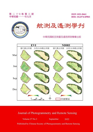
結合作物量測指標與無人機多光譜影像於茶樹生長評估

Title

Combining Crop Physiological Measurements and Unmanned Aerial Vehicle (UAV) Multispectral Images in Tea Tree Growth Assessment

作者

莊忠翰、陳忠義、蔡慧萍

Author

Zhong-Han Zhuang, Chung-I Chen, Hui Ping Tsai

中文摘要

茶樹生長狀況監測,除能瞭解各栽植階段之生理狀況,更可推估植物對逆境的反應及耐受性。本研究結合作物生理量測及無人飛行載具 (Unmanned Aerial Vehicle, UAV) 多光譜影像,發展一快速非破壞性且大面積的茶樹生長評估方法。同時討論自然和慣行農法茶樹生理表現與生長狀態差異,並分析生理數值和光譜植生指標的相關性。初步發現,自然農法茶樹具備韌性,且紅邊波段和作物生理數值相關性較高。本研究之快速且大面積的茶樹生長評估方法,有助於茶園耕種管理,亦可成為目前極端氣候下早期預警之重要參考依據。

Abstract

Monitoring tea tree growth status is essential for understanding physiological status at each planting stage and vegetation resilience to environmental stresses. The present study aims to develop a rapid, nondestructive, and large-area tea tree assessment method by combining crop physiological measurements and Unmanned Aerial Vehicle (UAV) multispectral images. Additionally, the differences in physiological performance and growth status of natural-based and conventional-based tea tree practices were discussed. Furthermore, the correlation between physiological measurements and spectral vegetation indexes was analyzed. The preliminary results have shown that the natural-based practice tea trees present high resilience, and the red edge spectral band has a higher correlation with crop physiological measurements. The proposed rapid, nondestructive, and large-area tea tree assessment method demonstrates a great opportunity for tea tree cultivation and management and future applications on early warning in the current extreme climate.

關鍵字

無人飛行載具、植物生理數值、光譜植生指標

Keywords

Unmanned Aerial Vehicle, Physiological Measurements, Spectral Vegetation Indexes

附件檔名

華芸線上圖書館

https://www.airitilibrary.com/Publication/Index/10218661-202209-202209290006-202209290006-131-150/

備註說明

N / A

Pages:

151-164

論文名稱

可見光及紅外熱影像之不同融合法於混凝土橋梁內部劣損檢測研究

Title

A Study on Different Fusion Methods of Visible Light and Infrared Thermal Images for Internal Damage Detection of Concrete Bridges

作者

張怡茹、高書屏、王豐良、林志憲

Author

Yi-Ru Zhang, Szu-Pyng Kao, Feng-Liang Wang, Jhih-Sian Lin

中文摘要

橋梁檢測可使用紅外熱影像顯示其內部劣損,但難辨別劣損位置,將其與可見光影像融合,即可獲得影像細節及溫度異常處。本研究使用小波融合 (WT)、拉普拉斯金字塔轉換 (LP)、非下採樣輪廓波轉換 (NSCT)、非下採樣剪切波轉換 (NSST),對混凝土橋梁內部劣損影像做融合,量測及比較內部劣損面積精度。實驗顯示LP難呈現紅外熱影像訊息,WT、NSCT及NSST能有效融合兩種影像,NSCT在污漬表面能凸顯紅外熱影像。NSCT與其他非破壞性檢測方法得到之面積相差0.057 m^2、0.005 m^2,NSST為0.094 m^2、0.007 m^2,WT為0.153 m^2、0.007 m^2。NSCT與實際面積最相近,且不受橋面污漬影響,故本研究推薦NSCT作為混凝土橋梁檢測使用。

Abstract

Bridge inspection can use infrared thermal images to display internal damage, but it is difficult to identify the location of damage. By combining infrared thermal images with visible light images, image details and temperature anomalies can be obtained. This study uses Wavelet Transform (WT), Laplacian Pyramid (LP), Nonsubsampled Contourlet Transform (NSCT) and Nonsubsampled Shearlet Transform (NSST) to fuse reinforced concrete bridge images, measure, and compare the accuracy of internal damaged areas. This study shows that LP is difficult to highlight the information of the original infrared thermal image, WT, NSCT and NSST can effectively integrate visible light image and infrared thermal image, and NSCT can highlight infrared thermal image. The area difference between NSCT and other non-destructive detection methods is 0.057 m^2, 0.005 m^2, NSST is 0.094 m^2, 0.007 m^2, WT is 0.153 m^2, 0.007 m^2. NSCT is the closest to the actual area and is not affected by the stains on the bridge deck, so this study recommends NSCT to be used for the detection of concrete bridges.
關鍵字

非破壞性檢測、影像融合、內部劣損檢測

Keywords

Nondestructive Testing, Images Fusion, Internal Damage Detection

附件檔名

華芸線上圖書館

https://www.airitilibrary.com/Publication/Index/10218661-202209-202209290006-202209290006-151-164/

備註說明

N / A

Pages:

165-178

論文名稱

整合可見光影像與熱影像重建三維熱紋理模型於橋梁檢測之研究

Title

Research on Integrating Visible Image and Thermal Image to Reconstruct 3D Thermal Texture Model for Bridge Inspection

作者

陳漢霖、高書屏、王豐良、林志憲

Author

Han-Lin Chen, Szu-Pyng Kao, Feng-Liang Wang, Jhih-Sian Lin

中文摘要

橋梁具有縮短縣市間距離之重要性,定期之橋梁檢測可以儘早發現劣損,並加以修繕,防止突發性的斷裂及崩塌等嚴重災情。近年來無人機 (Unmanned Aerial Vehicle, UAV) 應用於橋梁檢測發展迅速,其具備機動性高、時效性高、且可搭載各種儀器使檢測效能提升。本研究中透過無人機搭載數位相機及紅外線熱像儀拍攝橋梁影像,並設計一套影像處理之流程,將校準處理後之熱影像進行影像三維模型重建 (Image-Based Modeling, IBM),以利於判識內部劣損位置及三維空間之量測。研究中,於目標區域以打音診斷法獲得實際劣損位置,研究顯示三維模型空間幾何精度達到公厘級別,且於劣損區域之面積測量準確率優於96%。

Abstract

Bridges have the importance of shortening the distance between counties and cities. Regular bridge inspections can detect bad damage as soon as possible, and repair them to prevent serious disasters such as sudden ruptures and collapses. In recent years, the application of Unmanned Aerial Vehicle (UAV) in bridge inspection has developed rapidly. It has high mobility, high timeliness, and can be equipped with various instruments to improve the inspection efficiency. In this study, the bridge image was captured by a drone equipped with a camera system, and a set of image processing procedures were designed to reconstruct a 3D thermal texture model from the calibrated image, so as to facilitate the identification of the bad damage location and the measurement of the 3D space. In the research, the actual location of the defect was obtained by the impact acoustic method in the target area. The results showed that the spatial geometric accuracy of the 3D model reached the millimeter level, and the measurement accuracy of the surface of the inferior area was better than 96%.

關鍵字

無人機、熱影像、影像三維模型重建、橋梁檢測

Keywords

UAV, Thermal Image, Image-Based Modeling, Bridge Inspection

附件檔名

華芸線上圖書館

https://www.airitilibrary.com/Publication/Index/10218661-202209-202209290006-202209290006-165-178/

備註說明

N / A

Pages:

179-191

論文名稱

以福衛五號影像分析嘉義廢棄鹽田的太陽能產業發展

Title

Investigation on Development of Solar Energy Industry in the Salt Ponds of Chayi County Using Foremast-5 Imagery

作者

陳映璇、姚亮亘、張婷雅、吳秉勳

Author

Ying-Xuan Chen, Liang-Syuan Yao, Ting-Ya Chang, Bing-Xun Wu

中文摘要

本文透過福衛五號影像格點 G005 範圍,及參考 Google Map 衛星影像進行影像分析,藉由 QGIS監督式分類、實地訪查以及實驗結果,探討嘉義八、九、十區鹽田的昔今用途變遷,及太陽能光電廠分布差異,梳理出臺灣對於廢棄鹽田使用方式與未來規劃。臺灣近年太陽光電快速發展,本區廢棄鹽田轉型太陽能光電,成功提高經濟效益,但在轉型發展下,如何與當地居民取得共識,以及如何讓綠能發展與溼地復育及生態保留間達最佳平衡,是後續研究的重要議題。

Abstract

The research area is the eighth, ninth, and tenth districts’ salt evaporation ponds in Chiayi. To discuss the changes of these salt evaporation ponds, image analysis was carried out through the G005 grid of Formosat-5 image, by referring to the Google satellite image, the classified images of QGIS supervised analysis, field survey, and experimental data. The differences in the distribution of solar photovoltaic power plants were investigated to sort out the usage of abandoned salt fields as reference for future plans in Taiwan. Recently, with the rapid development of solar photovoltaics in Taiwan, the transformation of abandoned salt evaporation ponds into solar photovoltaics in this area increases economic efficiency successfully. Nonetheless, under the improvement of transformation, how to reach consensus with the local residents and how to make green energy development and environmental ecology coexist are both significant issues.

關鍵字

福衛五號、太陽能、鹽田、廢鹽田、監督式分析

Keywords

Formosat-5, Solar Energy, Salt Pond, Abandoned Salt Pond, Supervised Learning

附件檔名

華芸線上圖書館

https://www.airitilibrary.com/Publication/Index/10218661-202209-202209290006-202209290006-179-191/

備註說明

N / A

更多活動學刊