ENGLISH

28卷/1期

28卷/1期

華藝線上圖書館

Pages:

1-18

論文名稱

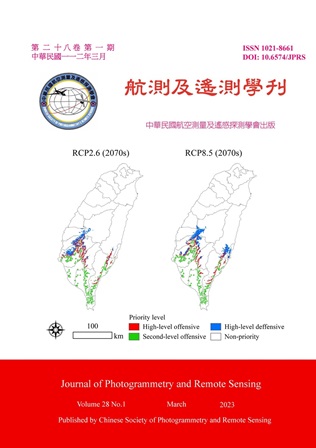
氣候變遷下美洲含羞草的空間防治優先性

Title

Spatial Prioritization for Invasion Prevention of an Invasive Plant, Mimosa Diplotricha under Climate Change

作者

黃靜宜、王素芬、呂明倫

Author

Jing-Yi Huang, Su-Fen Wang, Ming-Lun Lu

中文摘要

氣候變遷可能驅使入侵生物的分布擴張,掌握入侵擴散的空間資訊,有助遏阻或減緩其蔓延。本研究以美洲含羞草 (Mimosa diplotricha) 為例,透過MaxEnt與MigClim模式,模擬其入侵分布動態,並整合結構與功能連接度,建構氣候變遷下的空間防治策略。研究結果顯示,美洲含羞草偏好日夜溫度波動明顯的溫暖環境,暖化可能有利其分布擴張,預估未來將自當前棲地範圍,持續往北延伸擴張,惟促進擴散的關鍵途徑,將因暖化程度不同,而有所差異。整體而言,無論何種暖化情境,現有棲地範圍的北緣,皆應優先獲得控制,此外,隨暖化情勢的加劇,則更應側重未來促進擴散風險區位的防禦。

Abstract

Climate change may drive the range expansion of invasive species. Integrations of spatially explicit information are useful for preventing and managing. In this study, we used MaxEnt and MigClim modelling approaches to map current and future distribution dynamic of the invasive plant, Mimosa diplotricha. Then, structural and functional connectivity was integrated to develop the prevention strategies under climate change scenarios. The results showed that the suitable niche of M. diplotricha was a warm environment with the large variation in day-night temperature. The range of this species may increase due to a warming climate, with future expansion to the north of current suitable habitats. However, the critical routes of dispersal is likely to vary with the degree of warming. In conclusion, regardless of the warming scenario, the northern edge of the present habitat should be prioritized for control. In addition, as the warming increases, more attention should be paid to the defense of invasion risk areas in the future.
關鍵字

生物入侵、生態棲位模式、地景連接度、防治策略、電路理論

Keywords

Biological Invasion, Maximum Entropy, Landscape Connectivity, Prevention Strategies, Circuit Theory

附件檔名

華芸線上圖書館

https://www.airitilibrary.com/Publication/Index?DocID=10218661-N202304010009-00001

備註說明

N / A

Pages:

19-34

論文名稱

以高解析衛星影像輔以深度學習建置三維房屋模型

Title

3D Building Model Reconstruction Using High Resolution Satellite Images with Deep Learning Analysis

作者

呂振永、蔡富安

Author

Chen-Yung Lu, Fuan Tsai

中文摘要

利用衛星影像建置三維房屋模型逐漸受到討論,衛星影像的涵蓋範圍廣、時間解析度高,對於建置三維房屋模型,有一定的優勢。本研究主要針對以高解析光學衛星影像進行影像分析,並建立符合OGC CityGML LOD1等級之三維房屋模型。研究中應用深度學習,自動萃取出房屋平面圖 (Building Footprints),並去除非房屋多餘區域,之後利用最小包絡矩形 (Minimum Bounding Rectangle, MBR) 技術、正規化(Regularization)及約化 (Generalization)處理後,塑形出較規律房屋多邊形。最後,萃取房屋上層附屬結構物,並利用高程資料與RANSAC (RANdom SAmple Consensus)演算法擬合各多邊形高度,建立積木式三維房屋模型。經過校正與去除異常值,三維房屋模型平面及高程誤差皆可符合OGC CityGML LOD1規範。

Abstract

The use of satellite imagery to reconstruct 3D building models has gradually been discussed. Satellite imagery has a wide coverage and high temporal resolution, so there are certain advantages for reconstructing 3D building models. This research focuses on image analysis based on high resolution optical satellite imagery and 3D building models reconstruction with an accuracy of the OGC CityGML LOD1 level. Deep learning technique is applied in this study to automatically extract building footprints from satellite images and remove excess areas that are not buildings. Next, Minimum Bounding Rectangle (MBR), regularization and generalization processing are utilized to shape the more regular and square building polygons. Finally, sub-structures on the upper floor of each building are extracted, and the elevation data is used to fit the height of each polygon with the RANSAC (RANdom SAmple Consensus) algorithm to reconstruct block-based 3D building models. After corrections and removing outliers, the accuracy of the reconstructed 3D building models conforms to the OGC CityGML LOD1 specification.

關鍵字

高解析光學衛星影像、房屋平面圖、積木式三維房屋模型

Keywords

High Resolution Optical Satellite Imagery, Building Footprints, Block-based 3D Building Models

附件檔名

華芸線上圖書館

https://www.airitilibrary.com/Publication/Index?DocID=10218661-N202304010009-00002

備註說明

N / A

Pages:

35-47

論文名稱

基於特徵關係演算法創建線框模型之研究

Title

A Study on Feature Relationship Algorithm for Wireframe Modeling

作者

吳栩賢、謝佑明、莊子毅

Author

Hui-Yin Ng, Yo-Ming Hsieh, Tzu-Yi Chuang

中文摘要

點雲結構化為被廣泛研究之課題,現今演算法的適應性及成果的細緻度仍有改善的空間。本研究提出特徵關係 (Feature Relationship Algorithm, FRA) 演算法,FRA能萃取物件幾何之頂角隅特徵點和邊緣特徵點,並自動重建特徵點間之連線關係,獲得可描述物件幾何之線框模型。相較於現有演算法,FRA更適應物件之不同尺度和幾何變化,且具備高度自動化和細緻成果。初步驗證顯示,在模擬和點間距平均為3 cm的實際資料中,萃取出的VertexNode RMSE分別可達5 mm與4.3 cm,演算法能成功產製出完整的物件線框模型。本研究成果可望獲得提升不同幾何與不同尺度構件之點雲模型重建任務下的自動化及細緻程度。

Abstract

The study proposes a feature relationship algorithm (FRA) to establish wireframe models from object point clouds. FRA applies a scanning ball to explore local point cloud geometry for determining vertex and edge feature points and further reforms the spatial connections to reconstruct the wireframe model of the object automatically. Experiments on different variables were conducted to show insights into the effeteness of various point quality for FRA parameter configuration. Validations on data acquired from simulated and actual scans showed promising results, in which the RMSE of the model vertices achieved 5 mm in BIM-to-point cloud cases, and the RMSE of the real point cloud with a point interval of 3 cm data case comes to 4.3 cm. The FRA framework is expected to improve the automated level of point cloud modeling.

關鍵字

點雲特徵萃取演算法、特徵點連線關係、線框模型、自動化、幾何重建

Keywords

Point Cloud Feature Extraction, Feature Connection, Wireframe Model, Automation, Model Reconstruction

附件檔名

華芸線上圖書館

https://www.airitilibrary.com/Publication/Index?DocID=10218661-N202304010009-00003

備註說明

N / A

Pages:

49-62

論文名稱

高鐵雲林段黃金廊道一期稻作面積年際變化與地層下陷量關係探討

Title

The Discussion of the First Crop Rice Area and Land Subsidence on the Golden Corridor of Taiwan High Speed Rail in Yunlin County

作者

陳泓銓、王聖得、陳昶瑋、鐘藝方、鄭光佑

Author

Hong-Quan Chen, Sheng-De Wang, Chang-Wei Cheng, Yi-Fang Chung, Kuang-Yu Cheng

中文摘要

本研究用監督式影像分類,判釋2018、2020年上半年雲林地區福衛五號衛星影像,以QGIS分區統計功能,擷取水稻空間資訊,計算兩個年度高鐵黃金廊道內、外區域的水稻面積。並配合水利署地層下陷監測井資料,討論水稻面積變化與地層下陷的關係。研究結果發現高鐵黃金廊道內,2020年一期稻作面積較2018年減少的程度較高鐵廊道外明顯,且同期廊道內地層下陷量減緩程度亦較廊道外顯著。兩者在95%的信心水準下,通過t檢定,顯示廊道內、外在水稻面積減少量和地層下陷減緩的程度存在顯著差異,說明黃金廊道內可能因水田轉作為旱作,而使地層下陷有減緩的現象。

Abstract

In this study, we used the supervised image classification to interpret the Formosat-5 image in Yunlin area during the first season of 2018 and 2020. We used the function of QGIS Zonal Statistics to retrieve the spatial information of rice inside and outside the Golden Corridor, respectively. Based on the Land Subsidence Monitoring Wells data collected from the Water Resources Agency, we discussed the relationship between the changes in the rice area and land subsidence. We found that the area of the first crop of 2020 was significantly less than 2018 within the Golden Corridor. We also found that the decrease in the depth of land subsidence of the inner side, was also more significant than that of the outer area. At a 95% confidence level, the results of the t-test shows significant differences in the reduction of rice area and land subsidence on both the inner and outer sides of the Golden Corridor. The results also suggested that the policy of converting rice paddy fields to dry land farming is probably effective in reducing land subsidence.

關鍵字

地層下陷、一期稻作、衛星影像分析、監督式分類、統計檢定

Keywords

Land Subsidence, The First Crop Rice, Satellite Image Analysis, Supervised Classification, Statistical Tests

附件檔名

華芸線上圖書館

https://www.airitilibrary.com/Publication/Index?DocID=10218661-N202304010009-00004

備註說明

N / A

更多活動學刊