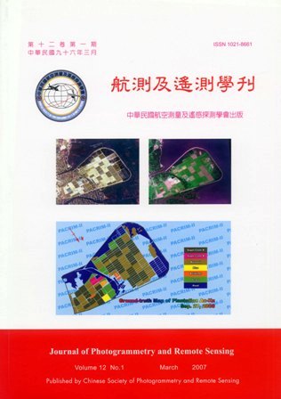
12卷/1期

12卷/1期

華藝線上圖書館

Pages:

1-16

論文名稱

應用半變異元模式於QuickBird影像中植生類別分類特性之研究

Title

Classification of Vegetation Cover Using Semivariogram Texture Information on Quickbird Image

作者

雷祖強,周天穎,鄭丁元

Author

Tsu-Chiang Lei, Tine-Yin Chou, Ting-Yuan-Cheng

中文摘要

在利用遙測資訊進行水稻田分類問題當中,光譜反應值接近的相異類別往往容易產生混淆,例如水稻田、草地與林地等。也就是說若以光譜資訊進行影像判釋時,將很難直接獲得較高的分類精準度。為解決此一問題,本研究嘗試於影像判釋時加入紋理資訊,擴大植生類別間的空間特徵差異性,進而提升高解析度衛星影像判釋時的精準度。本研究使用地理統計學(Geostatistic Theory)中的半變異元理論(Semivariogram Theory)作為紋理資訊之萃取模式, 模式的選定則是使用方向半變異元( Direct-Semivariogram ) 與交叉半變異元(Cross-Semivariogram)模式,以表達出植生類別間不同性質之紋理特徵資訊。另外,研究中也深入的討論了視窗大小、計算方向等影響分類成果之因子特性,以得到適合輔助水稻田判釋之紋理資訊。研究成果顯示,利用紋理資訊可有效的提升高解析度衛星影像判釋水稻田的精確度,而分類成果也將有助於相關單位制訂農業政策時之重要參考依據。

Abstract

The satellite image classification is one of the important application of remote sensing data.However, the vegetations (such as tree, grass and rice paddy) have very similar spectrum response insatellite images. This spectrum effect will caused to difficult classify each categories by using onlymulitspectral data. To resolve this problem, this study used to the semivariogram theory (textureinformation) to extracted each vegetations feature of the QuickBird image.This research used the Direct-Semivariogram and Cross-Semivariogram to calculate imagetexture. Further, variogram analysis was performed on Quickbird data to determine the nature ofspatial dependence with spectral reflectance for the selected vegetations of land cover systems whichis estimated by the mean of the ranges in a series of variograms. On the other hand, this study alsodiscussion the texture factor by the variogram analysis (such as window size, choose direction andband combination). Finally, the results showed semivariogram texture information which caneffectively improve the classification accuracy in high resolution satellite image.

關鍵字

植生類別判釋、高解析度衛星影像、半變異元、紋理資訊

Keywords

Very High Resolution, Satellite Image, Semivariogram, Texture Information,Quickbird.

附件檔名

華芸線上圖書館

N / A

備註說明

200703-12-1-1-16

Pages:

17-35

論文名稱

以DEM為高程控制之弱交會幾何衛星影像區域平差

Title

DEM Controlled Block Adjustment For SatelliteImages With Weak Converging Geometry

作者

陳良健;仝宜中

Author

Liang-Chien Chen, Yi-Chung Tung

中文摘要

資源衛星之主要用途為環境監測及資源探測,為求較大的影像覆蓋面積,通常不同軌道的影像重疊區域很小,且航帶間普遍具有較弱的交會幾何,傳統上以三維定位為考量之光束法平差模式將不適用。本研究將提出一個新的光束法平差程序,針對弱交會幾何之衛星影像,以數值高程模型作為航帶連結點之高程控制進行光束法平差,藉以降低重疊航帶間共軛點之相對偏移,並改善正射影像間銜接之品質。主要工作包括: (1)以光束法區域平差搭配數值高程模型作為高程控制,進行影像方位之重建,(2)進行衛星影像正射化,及(3)正射影像鑲嵌。實驗結果顯示,加入航帶連結點進行光束法區域平差,能有效降低重疊航帶間共軛點之相對偏移,並減少鑲嵌影像上重疊區影像錯開之現象。

Abstract

The major applications of the remote sensing images include the detection of natural resources and the monitoring for geoenvironment. In order to acquire largest possible coverage, the overlapping area of satellite images is small in general. In addition, the converging geometry is poor in common. Hence, the traditional 3-D bundle adjustment is not suitable for orientation modeling directly. The objective of this investigation is to propose a modified block adjustment procedure using DEMs as elevation control for multi-orbit satellite images. The major works of the proposed scheme are: (1) bundle adjustment using DEM as an elevation control, (2) generation of the orthophotos , (3) image mosaicking. Experimental results indicate that block adjustment can reduce the discrepancies for conjugate points between image strips. It is also demonstrated that the mosaicked image is better seamed when tie points are employed in the adjustment.

關鍵字

光束法平差、數值高程模型、影像正射化

Keywords

Bundle Adjustment, Digital Elevation Model, Orthorectification

附件檔名

華芸線上圖書館

N / A

備註說明

200703-12-1-17-35

Pages:

37-47

論文名稱

應用多變數轉化偵測法於多光譜影像變遷偵測

Title

Application of Multivariate Alteration Detection to Change Detection in Multi-spectral Imagery

作者

洪志賢;陳錕山

Author

Chih-Hsien Hung, Kun-Shan Chen

中文摘要

影像差異法為最簡單的變遷偵測方式,係兩時期影像相減。使用多光譜影像進行影像差異法,為了結合所有波段的變遷資訊,而將差值影像做主軸轉換。傳統主軸轉換使用差值影像的共變異矩陣之主成份分析(Principal Component Analysis)。本研究使用多變數轉化偵測法(Multivariate Alteration Detection,MAD),以典型相關分析(Canonical Correlations Analysis)為基礎,考慮兩時期影像間的交叉共變異矩陣,先行主軸轉換。本方法的特色在於線性轉換之不變性,可去除兩時期影像間大氣輻射的影響。再以轉換後影像,利用卡方統計檢定法(Chi-Square Test),判斷變遷區域,使偵測結果能更反應真實地表覆蓋的變遷。經過由差值影像與MAD 成分所得的變遷二位元影像,證明利用線性轉換的不變性,去除前、後期影像之間輻射強度的差別,可省掉相對輻射校正的前處理,還能排除因季節性引起的變遷。由模擬影像在不同信心水準下,雜訊比與整體精度的趨勢圖,雜訊比大小對於信心水準的選取沒有影響。而整體精度在訊雜比為10 以下較差,所以使用多變數轉化偵測法若其兩時期影像之訊雜比在10 以下便會對偵測的結果有較大的影響。

Abstract

When detecting changes in panchromatic images taken at different points in time, it is customary to analyze the difference between two images. Areas with little or no change have zero or low absolute values, and areas with large changes have large absolute values in the difference image. If image data gives more than two channels, it is difficult to visualize changes in all channels simultaneously. To solve this problem and to collect information on change, linear transformations of the image data can be considered. Traditionally, we make linear transformation by using principal component analysis via the covariance matrix of difference between two images. In this study, we perform linear transformation by applying multivariate alteration detection (MAD) by cross-matrix between two images. The property of the multivariate alteration detection transformation is the linear scale invariance. So, if we use MAD, preprocessing by linear radiometric normalization is superfluous. To detect the change areas by Chi-Square test, and the major changes is directly related to target changes, not seasonal or atmospheric effects. Results verify the effectiveness of the MAD method for change detection of multi spectral images.

關鍵字

變遷偵測、影像差異法、主成份分析

Keywords

change detection, principal component analysis, canonical correlation analysis

附件檔名

華芸線上圖書館

N / A

備註說明

200703-12-1-37-47

Pages:

49-58

論文名稱

以控制形變為基礎的縮編技術

Title

Map Generalization Based On Shape Distortion

作者

陳敏新;陳繼藩

Author

Min-Hsin Chen, Chi-Farn Chen

中文摘要

由於網路GIS 的普及以及空間圖資的日趨複雜,如何有效率以及快速的顯示圖資是一個重要的研究課題。而GIS 中的縮編技術,其目的除了是要有效率的降低資料的複雜度之外,同時必須保留主要的圖形特徵。然而一般在經過縮編的程序後,因為資料節點數目的減少,通常伴隨而來的是縮編後圖形的變形。因此本研究提出了一個以控制形變為基礎的縮編技術,以漸進式的方式進行縮編。在降低向量圖資資料量的同時,同時將縮編造成的形變量控制到最小。本研究將向量圖形的資料點分為主節點與次節點,以主節點保留圖形最明顯的特徵,再依縮編需求,由剩餘資料節點中找出擁有最小形變的次節點。為了要量化縮編前後的變化量,本研究定義一個形變指標(Shape Distortion Index)去描述兩個圖形的形變程度。本研究測試了多邊線與多邊形兩種資料,並且與最常使用的Douglas-Peucker 縮編演算法比較,在控制相同的縮編點數的條件下,本研究方法可以獲得形變量較少的縮編成果。

Abstract

The integration of multi-scale digital maps has recently become an important task because of the popularity of web-GIS and map-related mobile platform. In order to produce different scales of maps from the vector data, numerous map generalization techniques have been developed to automatically generalize the vector data. An ideal generalization technique not only decreases the number of data points but also retains the similarity of the simplified shape to the original ones as close as possible. This paper proposed a new generalization approach; which uses the curvature and the shape distortion as the controlling factors to implement the task. The proposed method classifies the data points as the primary points and the secondary points. Since the primary points are the points that represent the distinctive features of the shape, therefore, if the generalization only accepts the primary points that may result in an over simplification. Hence, it’s necessary to extract the secondary points to compensate the over-simplified situation. In this study, a Shape Distortion Index (SDI) is developed to detect the secondary points that can reduce the degree of the shape distortion efficiently. Two case studies are carried out to compare the proposed method with the commonly used Douglas-Peucker algorithm. The comparisons show that the proposed method has better-simplified results and less shape distortion both perceptually and quantitatively than Douglas-Peucker method.

關鍵字

地圖縮編、多邊形、形變

Keywords

Generalization, Polygon, GIS Data, Shape Distortion

附件檔名

華芸線上圖書館

N / A

備註說明

200703-12-1-49-58

Pages:

59-72

論文名稱

SAR 與SPOT 遙測資料融合於地表分類

Title

Fusion of SPOT and SAR Images for Land Cover Classification

作者

吳孟哲;陳錕山

Author

Meng-Che Wu,Kun-Shan Chen

中文摘要

本文比較利用主成份分析PCA 方法應用於像元階層資料融合技術與 Dempster-Shafer evidence theory 方法於特徵階層資料融合技術。在像元 階層資料融合中,由於合成孔徑雷達的資料具有全偏極特性,在此選取了對植被較為敏感的HV 極化合成孔徑雷達資料,與具有光譜特性的光學SPOT 資料做資料融合處理以利接下來的地物分類。首先,利用小波轉換技術濾除合成孔徑雷達斑駁雜訊,在接下來融合步驟中,主成分分析出來的第一部分(PC1)是用做完濾除雜訊後的合成孔徑雷達取代,在資料融合後,進行地物分類是採用最大似然法來分類融合影像。在特徵溶合中,利用全偏極雷達資料的極化特性結合SPOT 資料的光譜特性,提高分類的精確度。首先使用李式濾波器濾除全偏極雷達資料雜訊,接下來同樣是使用採用最大似然法來分類融合影像,(不同的在於全偏極雷達影像使用Wishart 機率分布,在光學影像採用multivariate Gaussian 機率分布) 將每個類別中每個像元屬於某個類別的機率值計算出來,再利用Dempster-Shafer evidence theory 來結合這些類別的機率值。 最後產生出一張新的分類影像。實驗的結果顯示分類的精確度比較於未融合的資料都有明顯提升的效果,也證明了此兩個資料融合方法對於不同資料特性的融合都是很成功的。

Abstract

In this paper, we compared image fusion of optical and radar images by pixel-level image fusion based on Principle Component Analysis (PCA), and feature-level image fusion based on Dempster-Shafer evidence theory. We combined the HV polarization information from SAR and spectral characteristic from SPOT images in an effort to enhance land cover classification. Before the fusion process, wavelet transform was first applied to denoise the SAR image which suffers from speckle contamination due to coherent process. PCA method is then used to fuse the SPOT and SAR images. In so doing, the PC-1 component is replaced by SAR image (approximation image, after wavelet transform) and then the inverse transform is followed. At last, the maximum likelihood classifier was used for both SPOT-XS images and fusion images. In feature-level case, fully polarization information from SAR is used to combine with spectral characteristic from SPOT images, mainly to enhance land cover classification as well. Speckle noise was removed by Lee filter, followed by the maximum likelihood classifier based on different distribution was used for SAR and SPOT images (Based on Wishart distribution and multivariate Gaussian distribution respectively), to extract the conditional probability of each pixel for each class. Finally, Dempster-Shafer evidence theory is then applied, to combine the classified results of SAR and SPOT data. Experimental results show that the classification accuracy is dramatically improved by effective image fusion of SPOT and SAR data. Excellent results were obtained by the proposed method.
關鍵字

像元等級影像融合、特徵等級影像融合、Wishart distribution

Keywords

Pixel-level image fusion, feature-level image fusion, Wishart distribution

附件檔名

華芸線上圖書館

N / A

備註說明

200703-12-1-59-72

Pages:

73-82

論文名稱

空載光達正高化算探討:以高屏地區為例

Title

Orthometric height reduction in airborne lidar operation,A Study with Kao-Hsiung and Ping-Tung area

作者

史天元;何心瑜;陳大科

Author

T.Y. Shih, H.Y. Ho, T.K. Chen

中文摘要

空載光達進行測量作業時,以GPS 為定位工具,故通常所得點雲之參考坐標系統為WGS84 系統,其高程為橢球高。產製正高系統之數值高程模型過程中,需利用大地起伏模式將橢球高改算為正高,提供民生使用。本研究使用內政部高屏地區空載光達地形測量之數據,並以一檢核路線視為真值,檢核空載光達所獲得之點雲橢球高誤差,DEM 部分之標準差為0.172 公尺。再以本研究進行當時之國內五個大地起伏數值模式進行正高化算,分析化算成果,比較檢核五模式。比較結果,若以Hw2001 為參考,以Hw2005成果較為接近,標準差為0.174 公尺, Hw2003 為0.199 公尺。此一成果顯示,其主要誤差成分為空載光達誤差,但是由於缺乏實測正高,具體差異尚難確實估算。

Abstract

In the general process, GPS is used for the positioning in the airborne lidar operation. Therefore, most frequently the height obtained is referenced to WGS84 ellipsoid and the measurements are in ellipsoidal height. In order to produce the digital elevation model in the orthometric height, the geoid undulation correction should be performed. This paper investigates the differences of five currently available digital geoid models of Taiwan area as applied to the airborne lidar point cloud obtained for the Kao-Hsiung and Ping-Tung area. Based on the differences between the result from the elevation obtained in the field and the elevation interpolated from the Lidar point clouds, the ellipsoid height are examined. The standard deviation for the ellipsoid heights is 0.172 m. Then, the orthometric height differences among those obtained from different models are compared. The standard deviation for Hwang-2005 is 0.174 m, and 0.199 m for Hwang-2001. Due to the lack of directly observed orthometric heights, the real error in terms of orthometric height is still difficult to confirm.

關鍵字

空載光達、正高化算、大地起伏

Keywords

Airborne lidar, Geoid undulation, Orthometric height

附件檔名

華芸線上圖書館

N / A

備註說明

200703-12-1-73-82

Pages:

83-92

論文名稱

以視訊影像製作及敷貼建物模型牆面紋理

Title

Facade Texture Generation and Mapping Using Digital Videos

作者

蔡富安;林后駿;陳正軒

Author

Fuan Tsai, Hou-Chin Lin,Cheng-Hsuan Chen

中文摘要

三維建物模型是數碼城市建置及應用中最重要的的元件之一。為建物模型加上接近實景的仿真牆面紋理,不僅可以增加視覺模擬時的場景真實度,在某些複雜的應用中,真實的房屋外牆紋理更可以提供重要的資訊。然而,目前大多數的建物模型製作系統並無法有效且快速地提供充足的仿真牆面紋理資訊。因此,本研究以視訊影像為主要材料,研發一套高度自動化的牆面紋理製作與敷貼系統,以期在數碼城市之建置及應用中能更經濟、有效地提供真實、完整且正確的建物牆面屬性。研究中利用角點偵測演算法自動化偵測出經校正過之視訊影像的特徵點,並透過影像位移及 Normalized Cross Correlation (NCC) 進行特徵點匹配以利製作具幾何連續性之紋理鑲嵌影像。影像重疊區的光影與色彩也經適當調校以產生無接縫 (seamless) 之完整鑲嵌影像。接著利用影像形態學演算自動化辨識紋理影像上之遮蔽區並判定有效之鏡射軸和鏡射區域,以鏡射方式填補對稱區域之遮蔽。最後透過線性及參數轉換將紋理影像敷貼至對應之建物模型牆面。以本系統製作並敷貼牆面紋理影像不僅賦予建物模型接近實景的外觀,也具備更完整且正確的牆面紋理屬性。更重要的是,本系統之運作只需少量的人工介入操作,因此對大型數碼城市的建置及應用有極大的助益。

Abstract

Three-dimensional (3D) building model is one of the most important components in a cyber city implementation and application. A realistic texture mapping of building models not only supplies authentic appearance of the models in visualization, it can also provide useful and sometimes critical features in complex applications. However, currently, most building models do not have sufficient and accurate texture information. In order to provide accurate texture attributes to 3D building models, this study developed a highly automated facade texture generation and mapping system for 3D building modeling. Seamless and photo-realistic texture mosaics of building facades were generated from video sequences acquired with consumer digital cameras and digital video (DV) camcorders. Extracted frame images were registered using a developed algorithm based on interest points identified semi-automatically to address concerns on the geometric alignment. A polygon-based blending algorithm based on alpha blending was then applied to integrate colors and shadings over the overlapped regions of adjacent images. As a result, the produced facade textures were continuous in both geometric outlines and color domains. Occlusions of generated facade texture mosaics were automatically identified and mended through a series of morphological operations. The corrected facade textures were mapped onto corresponding building facets correctly and efficiently using linear or parametric transformations. Test experiments conducted in this study demonstrated that the resultant building models had more complete and accurate texture attributes as well as near photo-realistic appearances. More importantly, comparing to conventional photo-based building texture mapping techniques, the developed algorithms are highly automated and provide a great advantage in large-scale cyber city implementations and visualizations.

關鍵字

紋理敷貼、影像鑲嵌、建物模型、影像形態學、視覺虛擬化、數碼城市

Keywords

texture mapping, image mosaicking, building model, image morphology, visualization, cyber city

附件檔名

華芸線上圖書館

N / A

備註說明

200703-12-1-83-92

Pages:

93-105

論文名稱

由近地面高解析光譜模擬之不同衛星光譜資料對水稻生長估測及產量預測產量上之差異

Title

Differences in Growth Estimation and Yield Prediction of Rice Crop Using Satellites Data Simulated from near Ground Hyperspectral Reflectance

作者

楊純明;陳榮坤

Author

Chwen-Ming Yang,Rong-Kuen Chen

中文摘要

Values of LAINB were found higher than those of LAISPOT 5 and LAIFORMOSAT-2 on the same sampling dates yet all the estimates were lower than the corresponding values of LAImeasured after ca. 55 days after transp lanting. As the simulated satellites data obtained lower values of NDVI and LAI than those of NDVINB and LAINB counterparts, yields predicted from satellites data were less than yield predicted from ground-based hyperspectral data. 本研究以近地面量測之水稻植被窄頻高解析光譜模擬法國史波特五號(SPOT 5)及臺灣福衛二號(FORMOSAT-2)之寬頻光譜資料,俾利用於比較其等對水稻生長估測與產量預測上相對於近地面測值之差異。近地面植被高解析反射比光譜(reflectance spectrum) 係由田間可攜式光譜儀(field-portable spectroradiometer)量測之,寬頻波段之反射比則以同波段各窄頻測值累加之平均值估算。根據試驗結果,由高解析光譜計算之標準化差植被指數(normalized difference vegetation index, NDVINB)及模擬衛星寬頻光譜計算之標準化差植被指數(NDVISPOT 5 及NDVIFORMOSAT-2)均於一、二期稻作生育過程中呈現非線性分佈,且分佈曲線之間幾近平行變化,惟模擬衛星光譜資料之NDVISPOT 5 與NDVIFORMOSAT-2 低於高解析光譜之NDVINB。地面實測葉面積計算之葉面積指數(LAImeasured)與NDVINB 之關係適用於指數生長型函數,據此將上述不同計算方式得到之NDVIs 輸入以獲得相對估測之葉面積指數(LAINB、LAISPOT 5 及LAIFORMOSAT-2)。結果發現約自移植後55 天起,在同一取樣日之LAINB 估值高於LAISPOT 5 及LAIFORMOSAT-2 估值,惟這些葉面積指數估值概低於相對地面實測LAImeasured 值。由於利用模擬衛星寬頻光譜資料獲得之NDVI 及LAI 估值低於近地面高解析光譜資料估算之相NDVINB 及LAINB,因此以模擬衛星光譜資料預測之水稻產量低於近地面光譜資料預測之產量,且均低於實測產量。

Abstract

The simulated broadband data of satellites SPOT 5 and FORMOSAT-2 were mimicked from canopy high-resolution reflectance spectra measured near ground, by a field-portable spectroradiometer, and these spectral data were then used to compare the differences in growth estimation and yield prediction of rice crop relative to those of ground measurements. Reflectance of broadband sensors was acquired by using the mean value of reflectance averaging over the respective waveband regions of hyperspectral data. Results indicated that the calculated values of normalized difference vegetation index (NDVIs) from hyperspectral (i.e. NDVINB) and simulated satellites data (i.e., NDVISPOT 5 and NDVIFORMOSAT-2) were all nonlinearly distributed during the first and second cropping seasons of rice. The curves were nearly parallel to each other, but values of NDVISPOT 5 and NDVIFORMOSAT-2 were lower than those of NDVINB. The relationship between the measured leaf area index (LAImeasured) and NDVINB was best fitted to an exponential growth function, by which the estimated values of LAINB, LAISPOT 5 and LAIFORMOSAT-2 were obtained using the respective NDVIs as inputs. Values of LAINB were found higher than those of LAISPOT 5 and LAIFORMOSAT-2 on the same sampling dates yet all the estimates were lower than the corresponding values of LAImeasured after ca. 55 days after transplanting. As the simulated satellites data obtained lower values of NDVI and LAI than those of NDVINB and LAINB counterparts, yields predicted from satellites data were less than yield predicted from ground-based hyperspectral data. These predicted yields were all lower than the measured yields.

關鍵字

水稻生長、產量預測、福衛二號衛星、史波特五號衛星、高解析光譜

Keywords

Rice growth, Yield prediction, FORMOSAT-2, SPOT 5, Hyperspectral data.

附件檔名

華芸線上圖書館

N / A

備註說明

200703-12-1-93-105

更多活動學刊