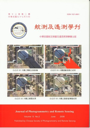
Geometric correction of remote sensing imagery is indispensable for the purpose of data integration and applications. Conventional ortho- recti-fication only considers the correction of tilt displacements and terrain relief displacements. Since high-resolution imagery captures more detailed information, the abrupt changes of object elevation result in the relief displacements and occlusions in images. In urban areas, high-rise buildings and multi-layer road systems of orthoimages cause serious image deformation. True-orthorectification procedures take account of ground objects for the correction of relief displacements and compensation of the hidden areas. Accordingly, the true orthoimages provide the exact position of land objects. This research focuses on the man-made constructions, including buildings and roads. Thus, the generation of true orthoimages is done by the integration of building, road, and terrain models. The test data comprises three dimensional building models, road models and digital terrain models. Multi-view aerial images are employed for the compensation of occlusions. The proposed scheme includes: (1) visibility analysis, (2) hidden detection, (3) hidden compensation, and (4) shadow enhancement. UltraCam-D imagery is used to validate the proposed scheme. The experimental results indicate that the proposed methods may produce quality true-ortho images with the accuracy between 1 and 2 pixels.
