15卷/2期

15卷/2期

華藝線上圖書館

Pages:

141-153

論文名稱

遙測技術於台北市土地覆蓋變遷之研究

Title

Application of Remote Sensing on Land Cover Change in Taipei

作者

林才添, 鄭祈全, 王素芬

Author

Tsui-Tian Lin , Chi-Chuan Cheng , Su-Fen Wang

中文摘要

本研究旨在應用遙測技術監測台北市土地覆蓋變遷情形。過程包括應用1993年和2007年二期SPOT衛星進行影像分類並產生土地覆蓋型圖;利用地景指數分析及Shannon多樣性t-檢定,評估台北市15年間的土地覆蓋變遷情形,並探討哪些行政分區對台北市土地覆蓋變遷造成影響。根據影像分類產生之土地覆蓋型圖進行地景指數分析與Shannon多樣性t-檢定之結果指出,台北市15年間的土地覆蓋變遷確實對整個地景造成顯著的影響,而12個行政分區中,有中山區、松山區、內湖區與萬華區四區對台北市地景具有顯著的影響。由上述結果可得結論為:(一)遙測技術於都市土地使用變遷研究,確實為一快速有效的方法,若再配合地景指數分析和地景Shannon多樣性t-檢定,可有效地監測都市土地覆蓋之變遷過程;(二)台北市從1993年到2007年15年間的土地覆蓋變遷已對台北市地景造成顯著的影響,因此台北市未來都市的永續發展應有更佳的都市發展模式,讓土地使用能更活化,以達到最好的土地使用價值。

Abstract

This study focuses on applying remote sensing techniques to monitor Taipei’s land cover change. The research processes include generating 1993 and 2007 land cover maps through image classification; assessing Taipei’s land cover change during the period of 15 years based on GIS, landscape indices, and Shannon diversity t-test ; and investigating the effect of administrative districts on Taipei’s landscape. The research result indicated that Taipei’s land cover change did have significant change from 1993 to 2007 according to land cover maps, landscape indices and Shannon diversity t-test. As for the effect of administrative districts on Taipei’s land cover change, the result showed that four districts (i.e. Zhongshan District, Songshan District, Neihu District, and Wanhua District) have strong significant effect on Taipei’s land cover change. From the above results, it is concluded as follows. (1) Remote sensing is an effective and useful tool for monitoring urban land cover change via landscape indices and Shannon diversity t-test. (2) According to the land cover change from 1997 to 2007, Taipei landscape is strongly affected by urban sprawl. Therefore, a detailed urban development model is needed to achieve Taipei’s sustainable development.

關鍵字

遙測、地理資訊系統、土地覆蓋變遷、地景指數、都市擴張

Keywords

Remote Sensing, Geographic Information Systems, Land Cover Change, Landscape Index, Urban Sprawl

附件檔名

華芸線上圖書館

N / A

備註說明

201006-15-141-153

Pages:

155-166

論文名稱

應用模糊分類法於光學衛星影像之對比增揚

Title

Image Enhancement of Optical Satellite Images Using Fuzzy C-Mean Classification

作者

張立雨, 陳繼藩,張宏宇

Author

L. Y. Chang, C. F. Chen, H. Y. Chang

中文摘要

一般用於光學衛星影像的對比增揚方法皆直接使用整張影像的統計資訊對所有灰階值進行增揚處理。但由於傳統的影像增揚方法必須犧牲原影像中較暗與較亮的區域或是出現機率較低之灰值來進行增揚,因此許多不同的地物特徵或細節通常難以同時增顯出來。本研究提出一種以模糊理論為基礎的影像對比增揚方法,先將單一像元視為數種類別的組合,並且針對各類別分別進行增揚對應函數之計算,藉以補償上述傳統方法中以全幅影像進行增揚所造成之問題。本方法主要分為三個階段:第一階段,以Fuzzy C-Means (FCM)群聚分類法對衛星影像作模糊式分類,將原始影像由灰階值空間轉換至歸屬值空間,分類後的各個像元由數個相應於類別比例的歸屬值所組成。第二階段,依照各類別的歸屬值,分別建立各類別的增揚轉換模型。第三階段,將歸屬值依照前一階段中建立的轉換模型轉換回灰階值空間。由於每個像元皆由數個類別的歸屬值組成,原始灰階值會依照各類別的轉換模型被增揚成數個不同的值。因歸屬值代表類別混合的比例,故以各類別歸屬值作為權重,重新組合此些不同的灰階值,得到最後的增揚成果。影像經增揚後,評估採用定性及定量方式,分別以人眼及量化指標判定增揚影像含有的資訊量及對比度,並將模糊分類式增揚法的成果與傳統常用的非線性直方圖等化及線性對比擴展法的成果比較。成果顯示對光學衛星影像而言,本研究提出的模糊分類對比增揚演算法對視覺而言可以提供較佳的影像品質,且表現比傳統方法更佳。

Abstract

Many image enhancement algorithms have been developed to improve the appearance of optical satellite images. However, it is usually difficult to enhance all land cover classes appearing in the images, because local contrast information and details may be lost in the dark and bright areas. In order to compensate the local brightness lost in the dark and bright areas, a fuzzy-based image enhancement method is developed to enhance the source image according to its fuzzified class information. The algorithm contains three stages: First, the satellite image is transformed from gray-level space to membership space by Fuzzy C-Means clustering. Second, appropriate stretch model of each cluster is constructed based on corresponding memberships. Third, the image is transformed back to the gray-level space by merging stretched gray values of each cluster. Various satellite images are used to test the proposed algorithm. Since the gray values of some classes are extremely dark or bright, apparently the global enhancement will result in poor contrast quality. After using the proposed enhancement method, the results are evaluated and compared with other conventional methods. The test results indicate that the proposed enhancement method can provide superior appearance and quality than other conventional methods.

關鍵字

對比增揚、模糊集合理論、Fuzzy C-Means

Keywords

Contrast enhancement, Fuzzy set theory, Fuzzy C-Means

附件檔名

華芸線上圖書館

N / A

備註說明

201006-15-155-166

Pages:

167-175

論文名稱

福衛二號影像應用於牡蠣棚架數量估算

Title

Application of FORMOSAT-2 Imagery on Estimating the Number of Oyster Scaffolding

作者

陳俊愷, 張國楨, 施明志

Author

Chun-Kai Chen ,Kao-Chen Chang ,Ming-zhi Shih

中文摘要

台灣平均每年受四到五個颱風侵襲,其所挾帶強風豪雨除常對居民生命財產直接或間接的損害,其中對農產品的損害更是難以估計。台灣浮筏式牡蠣棚架養殖海域近四萬四千公頃,每受侵襲、近乎全毀。在廣大海域以人工進行現地勘災,往往需要投入大量人力,農損估算及重建啟動,常逾半年之久。福爾摩沙衛星二號為每日再訪之衛星,其影像應有助於災後分析。本研究即福爾摩沙衛星二號影像,經影像處理、影像分類與GIS空間分析,進行台南沿海牡蠣養殖棚架個數估算,經與人工逐一判釋資料比較,具98.4%的準確度。未來藉由此快速準確的調查方法,將可提供進行沿海牡蠣養殖、長期掌握牡蠣養殖情形,於風災結束後,可於數小時內完成災情分析,有利於災後迅速重建。

Abstract

Typhoons, frequently visit Taiwan in average of 4 to 5 per year, often cause direct or indirectly damage to lives and properties, and the agricultural related damage is most severe due to the extremely strong wind and heavy rain. In Taiwan, the oyster culture occupies about 44 thousands of hectares, and the culturing raft is vulnerable to the attack of typhoon. Conventionally, the estimation of the typhoon caused damage of oyster culture requires considerable human effort for on-site investigation, and the whole process may last for more than 6 months. FORMOSAT-2, a satellite that passes Taiwan daily, is potentially a powerful tool to assist the estimation of typhoon caused damages. In the present study, through the image processing, classification and GIS spatial analysis of the FORMOSAT-2 images the typhoon cause damage to the oyster culture has been estimated. A 98.4 % of accuracy was obtained as compared with the result of on-site calculation. Therefore, we concluded that the analysis of FORMOSAT-2 images could provide a time saving but accurate method for damage estimation of coastal oyster farming. The completion of the analysis is within a few hours once received the images, and thus the oyster farm culture could be reconstructed with no time lagging.

關鍵字

福衛二號、衛星影像處理、影像分類、空間分析

Keywords

FORMOSAT-2, Satellite Image Processing, Image Classification, Spatial Analysis

附件檔名

華芸線上圖書館

N / A

備註說明

201006-15-167-175

Pages:

177-188

論文名稱

測量車多相機檢定

Title

Calibrating Cameras on a Mobile Mapping System

作者

吳建億, 蔡展榮

Author

Jieng-Yi Wu , Jaan-Rong Tsay

中文摘要

本文提出的測量車相機檢定(camera calibration)是解算相機的內方位元素、相機拍攝的像點系統性偏移向量、測量車上任意兩相機之間的相對方位,並且不使用檢定場而直接使用像點像坐標觀測值與各式物空間條件來解算。實驗結果顯示使用物空間條件檢定測量車相機參數是可行的,本文結合各式物空間條件,如物空間中可用的已知線段長度、角度、物點共平面、垂直條件、水平條件、坐標差值、高程差、已知點位高程以及已知點位坐標等,求解相機檢定參數,並分析檢定成果與精度。本文以物空間已知條件(距離、水平與垂直條件、坐標差值)求解的內、外方位元素精度可達 0.008~0.010mm、 1~13cm、 0.052˚ ~0.211˚。

Abstract

In this paper, the camera calibration for a mobile mapping system (MMS) is used to determine the interior orientation parameters, field of systematic bias vectors of image point positions, and the relative orientation of arbitrary two cameras on the MMS. Image coordinates of image points and diverse object space conditions are utilized to evaluate the aforementioned parameters without the need of moving the MMS into a calibration field. Test results show that the proposed calibration method using diverse object space conditions is applicable for calibrating cameras on a MMS. It integrates different kinds of object conditions (such as known lengths, angles, coordinate differences, coordinates, object heights as well as the perpendicular and parallel conditions) to estimate the camera parameters by using the images taken with the cameras mounted on a MMS. The object space conditions adopted in all tests include known distances, coordinate differences, the parallel and perpendicular conditions, and are used to determine the interior and exterior orientation parameters of all cameras on a MMS. The precision of the interior and exterior orientation parameters are about 0.008mm~0.010mm, 1cm~13cm, 0.052° ~0.211°, respectively.

關鍵字

相機檢定、滅點、物空間三軸條件、光束法平差

Keywords

Camera Calibration, Vanishing points, Conditions of three Orthogonal Axes in Object Space, Bundle Adjustment

附件檔名

華芸線上圖書館

N / A

備註說明

201006-15-177-188

Pages:

189-199

論文名稱

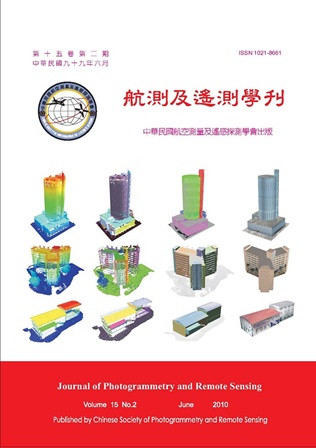
以模型樣版為基礎之建物三維點雲建模演算法

Title

Template-based Point Cloud Modeling for City Buildings

作者

賴泓瑞, 陳俊元,林昭宏

Author

Hung-Ruei Lai , Jiun-Yuan Cheng , Chao-Hung Lin

中文摘要

近年來光達掃瞄儀已廣泛的使用在量測領域上,光達可快速獲取高精度且高解析度點雲資料,因此相關點雲模型建置的技術也越來越受到重視。點雲資料模型重建面臨到的共同問題是如何處理點雲資料隱含的誤差,此外模型的邊角特徵突顯也會是一個重要的挑戰與問題。本研究提出一新的點雲建模技術,本技術是以階層式模型樣版為基礎對三維點雲資料進行模型重建,此樣版是由三個主要基本幾何元件構成,分別為平面、圓球以及圓柱,基本幾何元件皆以代數式描述。階層式模型樣版的第一層為自訂的基本幾何元件,接著利用基本幾何元件組合出下一層簡單形狀的模型樣版,然後進一步結合前層模型樣版以建立更高階複雜模型。其作法首先從點雲資料萃取出數個基本幾何點雲群集,再利用模型樣版進行點雲擬合,此模型樣版以線性代數式描述來取代非線性函式,因此在計算效率與演算法的強鈍性上有十足提升。此外,在每一模型樣版階層加入幾何約制條件以提高建模品質。實驗結果顯示本方法比利用隱性面函式建模方法在資料誤差的抵擋與建模品質上有更佳的表現,且比一般最小二乘法相關的重建方法在視覺上擁有更佳的建模品質。

Abstract

Digital scanning devices such as LiDAR have recently become affordable and available. They are capable of acquiring high-accuracy and high-resolution point clouds. Thus, the techniques for point cloud modeling have received increasingly attentions in the last decade. As the approaches reconstruct the point clouds, they face a common problem: how to handle point clouds with inherent noises. Moreover, it will be especially challenge in handing point clouds that contains sharp features, e.g., city buildings. In the paper, a novel template-based modeling approach for 3D point clouds sampled from unknown city buildings is introduced. A hierarchy algebraic template, comprising of three types of primitive geometries (that is, plane, sphere, and cylinder), is used to fit point clouds. The algebraic template is organized in a hierarchical manner. The first-level, i.e., the lowest-level, consists of the primitive geometries which are represented in algebra form. These primitive geometries are merged into 3D objects with simple shapes in the next level. These 3D objects are further joined to form the final template model in the last level. After the point clouds are partitioned into several geometric sets, the constructed template model is used to fit them. The point cloud fitting is archived by solving a least-square linear system instead of solving a non-linear one, making the approach efficient and robust in the modeling. The experimental results show that the approach is better, in terms of sharp feature fitting and noise withstanding, than the approaches based on implicit surfaces. In addition, comparing to the general least-square fitting approaches, the template-based fitting with geometry constraints improves modeling quality with respect to human visual system
關鍵字

點雲重建、點雲特徵萃取、最小二乘法擬合、代數型態模型樣版

Keywords

Point Cloud Reconstruction, Feature Extraction, Least-Square Fitting, Algebraic Template-Based Modeling

附件檔名

華芸線上圖書館

N / A

備註說明

201006-15-189-199

Pages:

201-203

論文名稱

第三十一屆亞洲遙測會議 出席報告

Title

作者

王蜀嘉, 陳良健

Author

中文摘要

Abstract

關鍵字

Keywords

附件檔名

華芸線上圖書館

N / A

備註說明

201006-15-201-203

更多活動學刊