18卷/1期

18卷/1期

華藝線上圖書館

Pages:

特刊引言

論文名稱

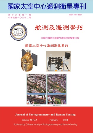
國家太空中心遙測衛星

Title

作者

張桂祥

Author

中文摘要

台灣於1991 年成立太空計畫,至今已逾二十年。福衛一號於1999 年發射,其中海洋水色照相儀為我國首次執行的遙測任務。福衛二號於2004 年發射,主要任務為地球觀測。福衛三號星系於2006 年發射,以六顆微衛星執行掩星大氣量測。由於遙測技術日新月異應用廣泛,並與國計民生息息相關,尤其是位處於天災頻繁的台灣,遙測任務遂成為台灣太空計畫的重要選項之一。 福衛二號發射後十年來在軌道上持續運作,不僅守護台灣,亦觀照全世界,在科學研究、支援救災、四季農作、支援外交、科普教育、環境監測等應用成果已獲國內外一致肯定。雖然福衛二號衛星本體及遙測酬載皆為外購,但太空中心於計畫執行中建立系統整合能量,並為推廣衛星影像之應用自力研發影像處理系統。福衛五號則是我國第一顆完全自主發展的高解析度遙測衛星,搭載一個黑白2米與彩色4 米解析度的遙測影像儀,接續福衛二號提供全球影像。目前已邁入衛星整合測試階段,預計於2015 年發射。 本特刊邀請國家太空中心同仁發表遙測衛星自主技術,內容涵蓋福衛二號與五號遙測酬載與影像處理。「福衛二號影像處理系統研發之回顧與展望 」說明太空中心自力研發影像處理系統的過程,並藉由支援全球重大事件,以提升自我技術能力與即時應用。「福衛二號排程與災防雲端應用服務」提到拍攝之通知、申請、排程,以及影像之查詢、訂購、遞交,將依國際標準透過雲端提供服務,並聯合其他衛星支援救災。「福衛五號遙測酬載系統工程經驗」說明自主發展遙測影像儀之系統設計與規格、影像品質影響因素、權衡分析、測試驗證等攸關任務成敗的系統技術。「福衛五號遙測酬載於軌道上的熱變形與光學表現分析」為高解度遙測衛星製造的一大挑戰,如何分析太空環境造成光學遙測酬載結構與熱變形對鏡頭成像的影響。「遙測衛星可靠度預估」說明如何分析電路方塊圖,並選用太空級電子零件以增進系統可靠度。「福衛五號非同步取像及其影像模擬」說明新增靈活取像模式,使得福衛五號能沿地表特定路徑以邊轉邊照方式取像。 在此懇請國內外各界先進專家,持續給予國家太空中心支持與協助,期待未來福衛五號順利發射運作,再啟台灣遙測新紀元。

Abstract

關鍵字

Keywords

附件檔名

華芸線上圖書館

N / A

備註說明

N / A

Pages:

1-12

論文名稱

福衛二號影像處理系統研發之回顧與展望

Title

FORMOSAT-2 Image Processing System Development and Outlook

作者

吳岸明, 張桂祥

Author

An-Ming Wu, Guey-Shin Chang

中文摘要

福衛二號於2004 年發射,是當今世上唯一能夠每日對全球任何地方取像的遙測衛星。影像處理系統自力發展,此對任務操作快速反應極有幫助。幾次世界大型災害,例如南亞海嘯、四川地震、八八水災、日本海嘯,福衛二號每次都以第一時間取像,並提供衛星影像支援救災。本文介紹福衛二號計畫影像處理系統(Image Processing System, IPS)自力研發之背景、目標、系統、操作,及自衛星發射後九年多之遙測任務成果與重大事件取像。影像處理系統包括五個次系統:取像排程次系統(Planning and Scheduling Subsystem, PSS)、資料擷取次系統(Data Ingestion Subsystem, DIS)、資料處理次系統(Data Processing Subsystem, DPS)、資料管理次系統(Data Management Subsystem, DMS)、影像品質次系統(Image Quality Subsystem, IQS)。福衛五號計畫在建立衛星本體與遙測酬載之自主技術能力,接續福衛二號任務。提供更高解析度之彩色影像,以及沿經線或海岸線之取像能力。為因應未來需求與挑戰,IPS 研發須利用網路技術,提供下一代衛星影像產品,並與GIS 緊密結合。

Abstract

Since launched in May 2004, FORMOSAT-2 is currently the unique high-resolution satellite having capabilities to daily image anywhere worldwide. The image processing system (IPS) was developed indigenously, so that it was helpful for the quick response to emergency events. FORMOSAT-2 has taken the first images and continuously monitoring after large disasters over the world to support the aftermath relief and precaution of secondary disasters, especially for the southern Asia tsunami, the Wilkins Ice Shelf disintegration, the Sichuan earthquake, the typhoon Morakot, and the Japan earthquake. In this paper we introduce the background, the goal, the system, and the operations of the Image Processing System (IPS), and the imaging activities and applications for the large events for nine years. IPS includes five subsystems: Planning and Scheduling Subsystem ( PSS), Data Ingestion Subsystem (DIS), Data Processing Subsystem (DPS), Data Management Subsystem (DMS), and Image Quality Subsystem (IQS). FORMOSAT-5 project is to build the indigenous capabilities of the spacecraft bus and the remote sensing instrument, and to continue the FORMOSAT-2 mission. It will provide the higher resolution images with the capabilities of imaging along the meridian or along the coastline. To meet the requirements and take the challenge, IPS will further utilize the network technology to provide the next-generation image products integrated with GIS.
關鍵字

福衛二號、影像處理系統、遙測照相儀、每日再訪軌道

Keywords

FORMOSAT-2, Image Processing System, Remote Sensing Instrument, Daily Revisit Orbit

附件檔名

華芸線上圖書館

N / A

備註說明

N / A

Pages:

13-27

論文名稱

福衛二號排程與災防雲端應用服務

Title

Cloud Computation Based FORMOSAT-2 Imaging Planning Service for Disaster Application

作者

張莉雪,陳伯傳,周士傑,陳乃宇

Author

Li-Hsueh Chang,Bo Chen,Shih-Chieh Chou,Nai-Yu Chen

中文摘要

福爾摩沙衛星二號 (簡稱福衛二號) 於2004 年發射,主要任務為獲取遙測影像以支援國內外遙測研發與應用。當災害發生後,於最短時間取得即時衛星影像將有助於災情快速研判提供緊急勘救災所需資訊。依前述考量,國家太空中心近年來除建置分散作業能量外亦發展即時排程雲端系統,依國際公認標準規範進行系統建置以期未來能結合不同衛星支援災情研判所需資料。此外,國家實驗研究院亦積極推動近即時高解析三維環境應用平台與災防平台,整合院內不同中心科技能量發展以台灣為主體之三維地球觀測災防應用平台,透過此平台福衛二號資料可望更有效應用於災防相關作業。

Abstract

Launched on May 20, 2004, the primary mission objective of FORMOSAT-2 is to acquire remotely sensed data to support domestic and international remote sensing researches for various applications. Providing a major disaster occurred, series of satellite data obtained at the first available time would be helpful for analyzing initial impacts and monitoring the following situations. To provide emergency service for disaster reduction operations, National Space Organization (NSPO) utilized multi-processing techniques to improve the efficiency of its image processing system. Also, a web-based sensor planning service compliant to OGC standard is developed. With which, the data from multiple satellites could be integrated properly to support disaster reduction activities. Aimed at visualization of the integrated data from sensor-web and analysis results from different scientific and application models, National Applied Research Laboratories (NARL) has conducted the development of a 3-D environmental application and disaster reduction platform. With this near real-time high resolution platform, one can visualize information integrated from FORMOSAT-2 and other sources and make a better decision for disaster reduction operations.

關鍵字

福衛二號、開放式地理資訊系統聯盟、取像排程、災防應用、雲端服務

Keywords

FORMOSAT-2, OGC SPS, disaster reduction application, cloud computation service

附件檔名

華芸線上圖書館

N / A

備註說明

N / A

Pages:

29-38

論文名稱

福衛五號遙測酬載系統工程經驗

Title

The System Engineering Experience of FORMOSAT-5 Remote Sensing Instrument

作者

劉小菁,曾世平,林喆,張和本

Author

Cynthia Liu,Michael Tseng,Jer Ling,Ho-Pen Chang

中文摘要

福爾摩沙衛星五號(以下簡稱福衛五號)是我國第一顆完全自主發展的高解析度遙測衛星,福衛五號搭載之主要酬載為一個提供黑白2 米,彩色4 米影像的遙測影像儀(Remote Sensing Instrument, RSI)。RSI 之影像感測器採用CMOS (Complementary Metal Oxide Semiconductor)而非傳統之CCD(Charge-Coupled Device), 為世界首例商用遙測衛星CMOS 感測器,在製造與性能上皆面臨很大的挑戰。 根據系統工程的基本程序(process),如需求分配(requirement allocation),系統分析(system analysis)與驗證(verification),與福衛五號發展的經驗並融合國內外專家學者經驗,將RSI 系統工程之必要流程與技術性探討過程記錄下來,是提供系統工程落實於遙測酬載之一實例,亦期能對後續遙測酬載的發展,建立一個足以傳承之依據。本文主要技術性探究部分著重在系統品質參數如對比轉換函數(CTF)、訊噪比(SNR)之探討。

Abstract

Scheduled to be launched in 2015, FORMOSAT-5 (FS5), equipped with 2-m panchromatic and 4-mmulti-spectral imaging sensor, is the Taiwan first self-reliant remote sensing satellite. Instead of using the traditional CCD sensor, FS5 RSI is equipped with a CMOS image sensor, the world's first commercial remote sensing CMOS image sensor. There are significant challenges in both performance and manufacturing. This article records the important RSI systems engineering processes and technical studies according to the basic systems engineering process (such as the requirement allocation, system analysis, and verification), and the development experience in FS5. Remote sensing instrument development experience from many domestic and foreign experts and scholars is being integrated into FS5 program. The systems engineering process example could become a guideline and basis for developing the future remote sensing payload. The technical part of this paper mainly focuses on the exploration of the key performance parameters such as system contrast transfer function (CTF), signal to noise ratio (SNR) etc.

關鍵字

福衛五號、遙測酬載、系統工程

Keywords

FORMOSAT-5, RSI, Systems Engineering

附件檔名

華芸線上圖書館

N / A

備註說明

N / A

Pages:

39-50

論文名稱

福衛五號遙測酬載於軌道上的熱變形與光學表現分析

Title

Optical Performance Analysis of On-Orbit FORMOSAT-5 Remote Sensing Instrument

作者

陳晉瑋,何承恩,楊美怡,陳嘉瑞

Author

Ching-Wei Chen, Cheng-En Ho,Mei-Yi Yang,Chia-Ray Chen

中文摘要

福衛五號計劃是第一個由國家實驗研究院國家太空中心自主研發的太空計劃,其中包括完整的衛星系統工程與光學遙測酬載的設計與製造。本研究進行太空環境與光學遙測酬載的模型建立與分析,並指出光學遙測酬載的結構與鏡面熱變形會進一步影響其光學性能表現。亦進行了一些初步的熱學與光機分析,探討光學遙測酬載於軌道上的行為,諸如溫度分佈、熱變形與成像品質劣化之間的關係。由於軌道上不同位置的熱負荷,光學遙測酬載在不同的取像位置其光學表現也將不同。本文詳細研究與探討熱變形的來源及其對成像品質的影響。

Abstract

FORMOSAT-5 is the first space program that National Space Organization (NSPO) takes full responsibility for the complete satellite system engineering design including payloads. FORMOSAT-5 will operate in a sun synchronous orbit at 720-km altitude with 98.28-degree inclination angle. The optical Remote Sensing Instrument (RSI) is a multispectral imager which contains one panchromatic band with 2-m ground sampling distance (GSD) and four multispectral bands with 4-m GSD. A Cassegrain type of RSI with two reflective aspheric mirrors and spherical corrector lens is designed. The space thermal environment is one of the important factors that affect the image quality of a space optical RSI. TRASYS and SINDA model of RSI have been established for thermal analysis. Both hot and cold cases have been studied. Thermal induced instabilities are incorporated in optical models (e.g., OSLO) by use of Zernike polynomial coefficients to calculate the system MTF and WFE. It is investigated that thermal deformation of RSI structure and mirrors will impact the optical performance. The relationship among temperature distributions, thermal deformations and image degradation of on-orbit behaviors are discussed.

關鍵字

光學遙測酬載,Cassegrain 型式望遠鏡、Zernike 多項式係數、光學傳遞函數MTF、波前像差WFE

Keywords

Remote Sensing Instrument (RSI), Cassegrain telescope, Zernike polynomial, MTF, WFE

附件檔名

華芸線上圖書館

N / A

備註說明

N / A

Pages:

51-58

論文名稱

遙測衛星可靠度預估

Title

Remote Sensing Satellite Reliability Prediction

作者

李宗平,彭家誠

Author

Tsung-Ping Lee,Jar-Chen Pong

中文摘要

遙測衛星因為可靠度要求相當高,設計時應具有複雜的備援功能。當進行可靠度預估時,首要了解系統的電路運作模式與關係,依其電路特性推導其對應的可靠度方塊圖。對於可靠度方塊圖中具有備援關係的方塊圖區塊,一般都可以找到對應的可靠度預估數學公式,若無適當的公式,則須自行推導公式。 可靠度方塊圖中的每一個方塊圖單元,其內的零件大都是串接關係,故其失效率只須相加零件失效率即可得,再由方塊圖計算得到系統可靠度預估值。本文將描述遙測衛星的可靠度預估過程,作為未來執行衛星或複雜系統的可靠度預估參考。

Abstract

Remote Sensing satellite shall be provided with complex redundant functions owing to its high reliability requirement. However, for generating its corresponding reliability block diagrams come from understanding operational scenarios, dependencies between the electrical circuits in the system and following the circuit’s characteristics. For a reliability block diagram contained redundant designs, normally the corresponding mathematical formulas of that reliability can be mapped accordingly. If no proper formula for that design can be used, the derivation of the fitting equations is necessary. In the reliability block diagram, most of the internal electrical parts have serial relationships. Hence, a grand total of the failure rates of the electrical parts can retrieve the failure rate in that block unit. Furthermore, to follow the reliability block diagram can evaluate the prediction of system reliability. This paper will describe the processes of reliability prediction in the Remote Sensing satellite system for referring in the future missions or predicting other complex systems.

關鍵字

遙測、衛星、可靠度

Keywords

Remote Sensing satellite, Reliability Prediction

附件檔名

華芸線上圖書館

N / A

備註說明

N / A

Pages:

59-66

論文名稱

福衛五號非同步取像及其影像模擬

Title

FORMOSAT-5 Asynchronous Imaging and Its Simulated Image

作者

黃楓台, 劉小菁,李芸珊

Author

Feng-Tai Hwang,Cynthia Liu,Yun-Shan Lee

中文摘要

福爾摩沙衛星五號(以下簡稱福衛五號)搭載一個黑白2 米,彩色4 米的遙測影像儀,是我國第一顆完全自主發展的高解析度遙測衛星。為了提升福衛五號取像的效率,增加一個所謂「靈活取像」(Smart Agility Imaging Mode)的非同步取像模式,使得福衛五號能沿地面特定方向以「邊轉邊照」方式取像。為了驗證「靈活取像」的可行性,太空中心依據遙測衛星取像程序完成系統的驗證,首先是非同步取像衛星姿態演算法的發展,接著是非同步取像衛星姿控演算法的開發,最後則是非同步取像模擬影像的展示。本文主要目的是介紹太空中心在非同步取像衛星姿態計算及其衛星影像模擬製作的發展。

Abstract

Scheduled to be launched in 2015, FORMOSAT-5, equipped with 2 m panchromatic and 4 m multi-spectral imaging sensor, is the Taiwan first self-reliant remote sensing satellite. To increase the efficiency for FORMOSAT-5 to acquire images on the ground, a function, so called “smart agility” or asynchronous imaging, is designed in FORMOSAT-5. With the function of asynchronous imaging, FORMOSAT-5 can rotate its body when it acquires images along a given specific direction on the ground. To verify the feasibility of smart agility mode for FORMOSAT-5, NSPO conducts a series of verification processes based on the sequence of satellite imaging. Firstly, the satellite attitude algorithm for asynchronous imaging mode was derived. Secondly, satellite on-board AOCS algorithm was developed. Lastly, simulated image was demonstrated. The aim of this article is to introduce some research results for asynchronous imaging in NSPO, including algorithms to calculate satellite attitude in asynchronous imaging mode, and asynchronous images simulation.

關鍵字

福衛五號、靈活取像、非同步取像、模擬影像

Keywords

FORMOSAT-5, Smart Agility, Asynchronous Imaging, Simulated Image

附件檔名

華芸線上圖書館

N / A

備註說明

N / A

更多活動學刊