22卷/3期

22卷/3期

華藝線上圖書館

Pages:

特刊引言

論文名稱

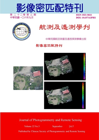
影像密匹配

Title

Dense Matching of Images

作者

蔡展榮

Author

Jaan-Rong Tsay

中文摘要

測量及空間資訊科技的發展日新月異,進步快速,就以影像的自動化量測技術之發展為例,2011年9月5-9日以及2013年9月9-13日於德國斯圖佳特大學(Universität Stuttgart)舉辦的第53屆及第54屆航測週(Photogrammetric Week)主題之一就是「點雲」,尤其是影像的「密匹配(dense matching)」,即:逐像元匹配(pixelwise matching),匹配整張影像的每一個像元,而且為了提升可靠度,採多張重疊影像的同名攝影光線(multi-ray)匹配(前後重疊80%、側向60%)得到高密度點雲,儼然已是攝影測量的最新發展主軸之一,它得到的數值地表模型(Digital Surface Model, DSM)點雲比光達點雲更加綿密,更有利於產製高精度高解析力的數值地形模型、正射影像、城市建模等各式應用。 在影像自動化量測的各種技術中,局部匹配法(local stereo matching methods)如標準化互相關法(Normalized Cross-Correlation, NCC)或最小二乘影像匹配(Least Squares Image Matching, LSIM)可靠度低,所以必須採用影像處理學的「全域匹配(global matching, GM)」來做。但是全域匹配GM的龐大計算量卻是無法忍受的,此法的困難之點是在可靠度以及計算量。微軟公司(Microsoft Corporation)的photosynth技術採用的也是GM運算技術。 而德國航空太空中心(Deutsches Zentrum für Luft- und Raumfahrt, DLR)的Heiko Hirschmueller博士帶領的研發團隊發展了所謂的半全域匹配法(Semi-Global Matching, SGM),對減少計算量很有效果,最經典的代表論文已由Hirschmueller發表於2008年和2011年。該法做的商用系統用在德國reality maps公司的服務上,該公司網站(http://www.reality-maps.de/)以及相關的一系列論文公開的匹配成果都顯示其密匹配點雲的結果遠比光達好,而且因為是逐像元匹配,所以其產製的DSM就可直接製作1比1的真實正射影像(true ortho image)。 筆者很高興於2015年10月接到中華民國航空測量及遙感探測學會的邀請,客編影像密匹配特刊,隨後立即開始著手進行邀稿,今年8月4日接到學刊編輯處通知,本學刊總編輯將甫於今年5月接受刊登的一般稿件一篇也納入本特刊中,合計五篇論文,歷時近2年,本特刊終於即將完成。 期待經由這份影像密匹配特刊的出版,能夠讓國內產官學界瞭解臺灣在影像密匹配相關技術的發展現況,並希望未來能有更多人能夠投入攝影測量及遙感探測的研發應用行列,為臺灣建立永續發展的航遙測產業奠定厚實的基礎。

Abstract

關鍵字

特刊引言

Keywords

Introduction to the Special Issue

附件檔名

華芸線上圖書館

http://www.airitilibrary.com/Publication/Index?DocID=10218661-201709-201709270004-201709270004-i-i

備註說明

N / A

Pages:

137-155

論文名稱

空照影像密匹配成果偵錯之瓶頸與解決辦法

Title

Bottlenecks and Solutions of Blunder Detection on Dense Matching Results of Aerial Images

作者

李硯婷、蔡展榮

Author

Yen-Ting Lee, Jaan-Rong Tsay

中文摘要

在攝影測量領域中,影像匹配技術已發展至密匹配(dense matching)的新紀元,此時密匹配成果之偵錯與品質評估面臨一些瓶頸,包括(1)無原始匹配點像坐標、(2)匹配點數量龐大、(3)相鄰匹配點之距離太近而產生相關參數的高相關,導致解算不穩定之現象。本文提出並使用四種簡易實用的密匹配成果偵錯與品質評估法,包括目視檢查法、相對方位法、像片三角法以及獨立測量法。使用的密匹配演算法為SMM、SfM、DAISY及SGM,偵錯成果顯示50.72%和47.00%的密匹配錯誤分別出現於高程1階不連續面(山形屋脊線)與0階不連續面,僅0.05%出現於均調區,此經驗可供密匹配研究與應用之參考。相對方位計算成果得到SMM、SGM錯誤率分別為2.82 %、2.36 %。經像片三角法之評估,SMM匹配精度為0.23 pixel;錯誤率為3.97 %。相對方位與像片三角法之偵錯速度分別為14,984 匹配點/秒、292 匹配點/秒。獨立測量法使用12個地面檢核點檢查成果顯示,SGM密點雲與佈標點高程之差值絕對值,最大值為0.935 GSD、最小值0.006 GSD、平均值0.315 GSD、RMSD等於0.238 GSD,此處的1 GSD=0.168 m。

Abstract

In photogrammetry, the development phase of image matching is moving into a new era, namely the dense matching. At this phase, there are bottlenecks for blunder detection and quality evaluation of dense matching results, including (1) no output on photo coordinates of matching points, (2) a huge number of matching points, and (3) unstable bundle block adjustment caused by too close matching points. This paper proposes four easy and applicable methods to overcome those bottlenecks. They are visual check, relative orientation (RO) using a huge number of tie points, bundle block adjustment, and comparing with check points. Four matching algorithms are tested, including SIFT-based Multi-image Matching (SMM), Structure from Motion (SfM), DAISY and Semi-Global Matching (SGM). The results show that 50.72% and 47.00% of wrong matching points appear at roof ridge lines and break lines. Only 0.05% of those wrong matching points are located in homogeneous color area. This might be for reference for development and application of image dense matching. Test results of RO method demonstrate that SMM and SGM have the wrong matching rate of 2.82% and 2.36%, respectively. The evaluation results of bundle block adjustment method show that the matching accuracy and wrong matching rate of SMM are 0.23pixel and 3.97%, respectively. Both RO and bundle block adjustment methods have the computation speed of 14,984 points/second and 292 points/second, respectively. By comparing 12 check points, the object points measured by SGM have the absolute elevation differences with maximum 0.935GSD, minimum 0.006GSD, average 0.315GSD and RMSD 0.238GSD, where 1GSD=0.168m.
關鍵字

密匹配、偵錯、品質評估

Keywords

Dense Matching, Blunder Detection, Quality Evaluation

附件檔名

華芸線上圖書館

http://www.airitilibrary.com/Publication/Index?DocID=10218661-201709-201709270004-201709270004-137-155

備註說明

N / A

Pages:

157-180

論文名稱

結合十字區塊匹配之半全域匹配法

Title

Integrating Cross-based Matching into Semi-Global Matching

作者

丁皓偉、趙鍵哲

Author

Hao-Wei Ting, Jen-Jer Jaw

中文摘要

近年來,電腦視覺廣泛運用立體視覺技術於各種領域,其中,藉由計算核線影像對共軛點的視差值,以重建目標物三維資訊的方法稱為立體匹配演算法,根據執行步驟的細節可分為:局部式、全域式以及半全域匹配法。立體匹配演算法可訴諸於逐像元之匹配,以產製出高密度點雲。 考量匹配效能及品質,本研究採用以半全域匹配法為主的立體匹配演算法來進行高密度點雲產製的任務,然由於此演算法本身對於懲罰參數設定具有高度敏感性,本研究藉由結合十字區塊匹配法以降低前述效應。除此之外,本研究提出的因應策略為作業參數(含自動化懲罰參數設定)的設定方式,以完備實務操作面並充分支援視差匹配及生產高品質的三維場景。

Abstract

In recent years, there is an extensive use of computer vision and stereo vision techniques in various fields. Among them, stereo matching algorithm aims to reconstruct 3D models by calculating disparities of conjugate points in epipolar image pair. Based on the detailedness it would involve, the stereo matching can be divided into the following categories: Local algorithm, Global algorithm and Semi-Global Matching (SGM). When it comes to performing pixel-wise matching, the stereo matching technique can be utilized to generate dense point clouds of the interested scene. This study employs a SGM based stereo matching algorithm with a good trade-off between runtime and accuracy to generate dense point clouds. Cross-based Matching, a local algorithm is integrated into SGM to ease the high sensitivity of parameters chosen in penalty function. In addition, the ranges of parameters needed in carrying out the matching operation have been suggested to support practical as well as quality disparity estimation, and thus a satisfactory 3-D scene reconstruction.

關鍵字

高密度點雲、立體匹配、十字區塊匹配法、半全域匹配法

Keywords

Dense Point Clouds, Stereo Matching, Cross-based Matching, Semi-Global Matching

附件檔名

華芸線上圖書館

http://www.airitilibrary.com/Publication/Index?DocID=10218661-201709-201709270004-201709270004-157-180

備註說明

N / A

Pages:

181-191

論文名稱

半全域匹配法於福衛二號立體影像之數值地表模型重建

Title

Semi-Global Matching for DSM Generation using Formosat-2 Stereo Images

作者

張智安、郭怡伶

Author

Tee-Ann Teo, I-Ling Kuo

中文摘要

像空間半全域匹配法(Semi-global matching, SGM)需使用核影像像對進行核線幾何約制,若使用線列式掃描器成像之衛星影像進行SGM,便須解決其核幾何與像幅式影像不同之問題,因此本研究提出物空間半全域演算法(Object-based SGM, OSGM)重建數值地表模型(Digital Surface Model, DSM)。研究中比較特徵式匹配及物空間半全域演算法於數值地表模型重建之差異,其中特徵式匹配僅針對特徵點進行匹配,再將匹配成功的特徵點三維點雲網格化為DSM,而OSGM則是在物空間逐點式密匹配,直接產生影像正射化所需的DSM。本研究使用福衛二號同軌立體像對進行實驗分析,特徵式匹配之三維點雲為OSGM的15%;分別使用特徵式匹配及OSGM DSM建立正射影像,正射影像視差之標準偏差分別為3.07像元及1.94像元,代表OSGM建立的DSM具有較佳的精密度。

Abstract

Image-based semi-global matching (SGM) utilizes epipolar images as a geometrical constrain in image matching. However, the epipolar geometric of frame camera and push-broom satellite images are not the same. Therefore, the traditional image-based SGM cannot be applied to push-broom satellite images directly. This study proposed an object-based SGM (OSGM) to overcame the problem of non-linear epipolar line for push-broom satellite image. The aim of this study is to generate the digital surface model (DSM) for image orthoretification using proposed OSGM. This study also compare the DSM generated from feature-based matching and OSGM. The feature-based matching only performs the image matching on particular feature points. Then, the 3D coordinates of feature points are interpolated into DSM. The experimental images are Formosat-2 in-track stereo images, the number of 3D points generated from feature-based matching is 15% of OSGM. We use these two DSMs to produce orthoimages, the standard deviations of disparity between orthoimages are 3.07pixels and 1.94pixels, respectively. The DSM generated from OSGM show higher relatively accurate than the one from feature-based matching.

關鍵字

半全域匹配、數值地表模型、福衛二號

Keywords

Semi-Global Matching (SGM), Digital Surface Model (DSM), Formosat-2

附件檔名

華芸線上圖書館

http://www.airitilibrary.com/Publication/Index?DocID=10218661-201709-201709270004-201709270004-181-191

備註說明

N / A

Pages:

193-203

論文名稱

利用SGM和PMVS演算法進行MUAV影像密匹配之比較分析

Title

Comparision Dense Matching of MUAV Images via SGM and PMVS

作者

林迪詒、謝嘉聲

Author

Di-Yi Lin, Chia-Sheng Hsieh

中文摘要

現今無人機(Unmanned Aerial Vehicle, UAV)技術發展成熟,在拍攝影像上兼具即時性和方便性,藉由拍攝而得的影像可快速重建出近似實景的三維資訊。UAV影像在空間資訊的應用大致區分為環繞拍攝整棟建物建立完整三維模型之應用及垂直拍攝地形產製正射影像製圖使用。目前因相關技術發展快速,在影像處理如特徵點偵測、特徵點匹配大都有合適的演算法進行處理,惟有在稠密點雲匹配計算過程中,尚未有較理想的處理方法。 為探討不同密匹配方法的特色及適用性,本研究中選取不同理論基礎且較廣泛使用的兩種密匹配方法進行比較,以半全域演算法(Semi-Global Matching, SGM)及全域演算法(Global Method)中基於區塊方法(Patch-based Multi-view Stereo, PMVS)匹配,分別將兩種密匹配演算法應用在進行環繞拍攝之單一古蹟建物及垂直拍攝校園之影像中比較分析,藉由實務之比較分析,提供利用UAV拍攝影像重建三維點雲處理之參考。

Abstract

The Unmanned Aerial Vehicle (UAV) has been developed mature. It is both immediacy and convenience on the field of images shooting. The three-dimension information that close to real can be constructed via the images which taken from UAV. The utilizing on geospatial of UAV is construct complete three-dimension model from shooting a building surround and produce orthophoto from shooting topography vertical. There are good algorithms both on the field of set up relative relationship between ground and images and calculating camera parameters because of the well developing of relative technique; only on the field of the procedure of calculating dense point cloud has not been developed a suitable method. In order to investigate characteristics and applicability of different dense matching, two methods from different theoretical basis and both widely used are chosen in this study, including Semi-Global Matching (SGM) and Patch-based Multi-view Stereo (PMVS) from Global Method. We use these two methods to analyze the images taking from shooting a historical sites surround and campus vertical. The result can be a reference for construct three-dimension point cloud from the images taking from UAV.

關鍵字

UAV、三維建模、密匹配、SGM、PMVS

Keywords

UAV, 3D Modeling, Dense Matching, SGM, PMVS

附件檔名

華芸線上圖書館

http://www.airitilibrary.com/Publication/Index?DocID=10218661-201709-201709270004-201709270004-193-203

備註說明

N / A

Pages:

205-226

論文名稱

應用空載傾斜攝影密匹配點雲於建物變遷分析

Title

Change Detection of Buildings Using Point Cloud Generated by Dense Image Matching with Oblique Aerial Images

作者

陳韻安、饒見有

Author

Yun-An Chen, Jiann-Yeou Rau

中文摘要

隨著都市化的發展,都市的環境變化急遽,為了掌控土地資源與土地利用之狀況,如何有效與快速的進行都市環境變遷與監控便顯得更重要。當城市空間資訊往第三維度快速增長時,傳統垂直航拍影像所提供的資訊已不敷使用。然而空載傾斜影像能拍攝較完整的地物立面資訊,且傾斜視角具立體感,人員不需專業訓練即可判釋各式地物,國際上已逐漸應用於都市地區的地物偵測,例如地震後房屋傾倒之全面清查。本文以無人飛行載具及有人機蒐集兩個時期的傾斜與垂直空載影像,利用自動化特徵匹配產生連結點,搭配地面控制點與空三平差求解影像絕對方位,並透過密集影像匹配技術產製兩時期之三維彩色點雲,尤其傾斜視角的建物牆面資訊能提供更細緻且密集的牆面點雲以利建物判釋。空載影像以物件導向式影像分類法進行地物分類,利用反投影公式搭配HPR(Hidden point removal)運算子提供三維點雲地物類別之資訊,並建立相同的區域體元(voxel)座標系統,在三維空間中針對建物進行變遷偵測,並計算獨立建物變遷區塊之體積。

Abstract

Due to the rapidly urbanization development, to monitor the change of city environment is more and more important for urban land resource management. Different to traditional vertical aerial imagery (VAI), the oblique aerial imagery (OAI) is more stereoscopic for manually recognition, and has more information practically on building façade. Various studies has investigated the potential of its applications, such as building seismic damage assessment, building objects extraction and classification and so on. In this study, both vertical aerial imagery (VAI) and oblique aerial imagery (OAI) are collected from airborne and UAV platform in two different periods for building change detection purpose. Through photogrammetry techniques including orientation reconstruction and dense image matching, the colored high density 3D point clouds of two period data are generated from both vertical and oblique images. We apply object-based image analysis (OBIA) to classify the images into several classes of the cyber-city. Then, two period of point clouds with information of classes which is extracted from classified images are generated by back-projection and Hidden Point Removal opereator. To detect the change of building, two point clouds are normalized to local voxel coordinate system. Voxel-based change detection is performed to detect the building change in 3D space and calculate the volume.

關鍵字

空載傾斜影像、分類點雲、變遷偵測

Keywords

Oblique image, Classified Point cloud, Change detection

附件檔名

華芸線上圖書館

http://www.airitilibrary.com/Publication/Index?DocID=10218661-201709-201709270004-201709270004-205-226

備註說明

N / A

更多活動學刊