23卷/4期

23卷/4期

華藝線上圖書館

Pages:

223-243

論文名稱

以光學框幅式影像進行水位面及水下物點定位之定性分析

Title

On Qualitative Analysis of Determining Water Surface and Underwater Object Point Using Optical Frame Imagery

作者

李冠臻、趙鍵哲

Author

Kuan-Chen Lee, Jen-Jer Jaw

中文摘要

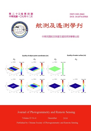
水下空間資訊測量方式多元,搭配不同的載台及相異的感測方式,各有其適用場域及測製標的。本研究探討利用光學影像成像幾何,以光線追蹤方式進行攝影測量水下物點三維定位分析。為簡化探究主題,本研究目前基於靜止之水位面以及單一水中介質之假設,採用可掌握的物理及光學現象,在內外方位參數已知的條件下,依共線特性及折射效應建立自空氣至水中光線路徑,據以進行物像對應,解析影像中可視水下物點三維坐標;考量實務需求及作業條件,在物像對應模式中,水面位置可為未知參數或觀測量,在幾何條件俱足下,能與水下物點坐標一同解算;在物像對應模式上,本研究現階段主要探討對象為框幅式影像,並依前述條件建構帶有約制的廣義最小二乘法平差解算系統。為有效釐清同時解算水位面及水下物點課題重要幾何特性及定位品質,本工作現階段著重於設計模擬資料並以控制變因方式進行實驗及定性分析,成果包含幾何條件探討、參數可解性分析、影響因子及定位分量品質評估,並據以作為精進自空氣往水下進行水下場景三維定位任務之基石研究。

Abstract

With the ever-changing photogrammetry technologies and different types of sensing instruments, a wide range of methods and alternatives can be applied for mapping underwater geospatial information. Among them, ray tracing of optical imagery is targeted to determine the underwater object points in this study. To simplify the task, it is assumed that all involved media are homogeneous and the water surface is still. Under the ideal physical and optical phenomenon with the known interior/exterior orientation parameters, the object-to-image correspondence of whole imaging paths of visible points can be retrieved by considering both collinearity condition and refraction effect. With that, the position of the water surface can be an observation or unknown parameter being solved together with underwater object points in accordance with practical requirements. Current study only considers imagery acquired by frame cameras and the generalized least-squares adjustment model with constraints is employed to carry out an effective parameter estimation. To characterize the core issues of this study and qualitatively verify the positioning quality varied with the influential factors, simulation data and experiments are well designed and conducted. The results of geometric conditions, solvability analysis of parameters and positioning quality tuned by influential factors are fully addressed and concluded, implementing a cornerstone for the air-to-water photogrammetric intersection solving for water surface and underwater object points.

關鍵字

光學影像、水下物點、水位面、光線追蹤、共線特性、折射、約制

Keywords

Optical imagery, Underwater object point, Water surface, Ray tracing, Collinearity property, Refraction, Constraint

附件檔名

華芸線上圖書館

http://www.airitilibrary.com/Publication/alDetailedMesh?DocID=10218661-201812-201812270003-201812270003-223-243

備註說明

N / A

Pages:

245-256

論文名稱

應用UAV 影像於山坡地作物判釋之探討

Title

Utilizing Unmanned Aerial Vehicle Images to Interpret Crop Types in the Hillside Area

作者

李瑞陽、歐鐙元、徐嘉徽

Author

Re-Yang Lee, Dang-Yuan Ou, Chia-Hui Hsu

中文摘要

本研究探討UAV (Unmanned Aerial Vehicle) 於臺灣山區作物分類時,可帶來效益及面臨的問題。首先利用無人機(UAV)取得臺中太平區的正射鑲嵌影像,接著運用eCognition 軟體中的多尺度分割功能對影像進行物件分割,然後判釋分割區塊內之作物。因研究區內的「龍眼荔枝」類別與樹林難以有效區分,無法自動化分類,因此本研究針對分割後之影像區塊進行人工判釋,正確率分別在「龍眼荔枝」為88.2%、「樹林」為96.5%、「苗圃」為96.8%、及「其他」為99.7%。最後本研究提出透過不同時期影像,以龍眼與荔枝不同的花期進行區分,以及利用影像分割區塊進行地真資料蒐集的效率等建議,供後續相關研究參考。

Abstract

The purpose of this study is to explore the benefits and problems by using UAV images in the crop classification of slope areas in Taiwan. We first made use of UAV to obtain the mosaic orthoimage in the hillside of Taizhong Taiping District. The eCognition multi-scale segmentation was then utilized to create image blocks. The crop types in the research area were then interpreted in an object-oriented manner. Because the category of “Longan (Dimocarpus longan) and Litchi (Litchi chinensis)” in the research area was difficult to distinguish effectively with the forest, which led to the difficulty of automatic classification, this study adopted artificial interpretation. The classification accuracies indicated that “Longan (Dimocarpus longan) and Litchi (Litchi chinensis)" was 88.2%, forest was 96.5%, nursery was 6.8%, and others was 99.7%. Finally, this study suggests to differentiate Longan (Dimocarpus longan) and Litchi (Litchi chinensis) using different flowering stages and to improve the efficiency of field data collection using segmentation blocks for subsequent research.

關鍵字

無人飛行載具、多尺度分割、物件導向

Keywords

Unmanned Aerial Vehicle (UAV), Multi-scale Segmentation, Object-oriented

附件檔名

華芸線上圖書館

http://www.airitilibrary.com/Publication/alDetailedMesh?DocID=10218661-201812-201812270003-201812270003-245-256

備註說明

N / A

Pages:

257-271

論文名稱

手持式三維掃描儀於坑道測量之可行性分析

Title

Feasibility Analysis of the Handheld 3D Scanner in 3D Tunnel Survey

作者

洪翎嘉、王聖鐸、黃傳楷

Author

Ling-Chia Hung, Sendo Wang, Chuan-Kai Huang

中文摘要

過去受限於技術與設備,只能將三維空間資訊投影在二維地圖上展現;近年來拜電腦軟硬體突飛猛進之賜,三維空間資訊的展現已經可以用虛擬實境(Virtual Reality, VR)甚至擴增實境(Augmented Reality, AR)的方式展現,不僅更直覺,也更詳實而精確。坑道測量受限於封閉環境,過去僅以平板儀或經緯儀測繪平面圖表示。以近景攝影測量測繪坑道三維模型,必須大量佈標、廣設控制點及光源,需大量人力且花費時間。地面光達(Light Detection and Ranging, LiDAR)搭配相機攝像,可以快速獲取坑道三維點雲(Point Cloud),是最適合坑道三維測量的選項。但地面光達所費不貲,且彎彎曲曲的坑道必須分別設站掃描,再將各場景連接起來,需要高階的電腦及專業的人力才能處理。近來有廠商推出手持式三維掃描儀,採用結構光(Structured Light)原理,可快速擷取近距離(約4 m 內)三維點雲,理應相當適用於坑道三維測量。因此本研究採用DotProduct 公司出品的DPI-8 手持掃描儀作為實驗組,並以FARO 公司出品的Focus3D 地面光達作為對照組,於花蓮七星潭四八高地下方坑道進行測量。將兩者所得的三維點雲,透過開源軟體Recap360 以及CloudCompare 進行三維資料的比較,了解手持掃描儀於狹小且缺乏光源的坑道中進行測量工作的可行性。

Abstract

Traditionally, 3D spatial information can only be projected on the 2D maps for visualization due to the limitation of equipment and technology. Benefit from the rapid development of computer hardware and software, 3D visualization of the 3D spatial information can be achieved either by virtual reality (VR) or by augmented reality (AR). The 3D visualization is not only much more ocular for human, but also much more detailed and accurate. Due to the close environment and the spatial limitation, the tunnel survey is usually carried out by the plan table or the theodolite. The 3D tunnel is projected on the 2D map. Although close-range photogrammetry can be used to reconstruct the 3D model and to survey 3D coordinates of the tunnel, it requires many artificial targets as control points. Additional light sources are also necessary for shooting clear photographs. These requirements leads to huge labor work and consumes time. The terrestrial light detecting and ranging (LiDAR) integrated with a camera is capable of acquiring 3D point cloud in an efficient way, and therefore, is very suitable for tunnel survey. However, the terrestrial LiDAR is too expensive to be adopt by non-surveyors. In addition, due to the winding design of the military tunnel, it will require much more station setups to scan the whole tunnel. The connection of every scanning scene requires a powerful computer and professional human interaction. Recently, the handheld 3D scanners are developed based on the structured light approach, which can rapidly scan 3D point cloud within a short distance (within 4 meters). In this study, we apply a DotProduct DPI-8 handheld 3D scanner and a FARO Focus3D terrestrial LiDAR in the tunnel survey under the 48 Highland in Ci Sin Tan, Hualien. We compare the requirements, the operating procedures, and the results of the handheld 3D scanner and of the terrestrial LiDAR. The results show that the handheld 3D scanner is very suitable for the tunnel survey.

關鍵字

手持式三維掃描儀、地面光達、坑道測量

Keywords

Unmanned Aerial Vehicle (UAV), Multi-scale Segmentation, Object-oriented

附件檔名

華芸線上圖書館

http://www.airitilibrary.com/Publication/alDetailedMesh?DocID=10218661-201812-201812270003-201812270003-257-271

備註說明

N / A

Pages:

273-284

論文名稱

以球形及圓柱投影之環景影像產製三維點雲

Title

The Generation of 3D Point Clouds from Spherical and Cylindrical Panorama Images

作者

張智安、張正岳

Author

Tee-Ann Teo, Cheng-Yueh Chang

中文摘要

使用多相機同步取樣系統於三維點雲產製時,可採用原始多相機相幅式影像(Frame image)或拼接後之環景影像(Panorama image)。環景影像為一涵蓋360 度之影像,多相機影像可使用不同的投影方式產生環景影像,例如球形投影及圓柱投影。本研究探討不同投影方式之多相機影像於三維點雲重建,不同投影影像包含:(1)未拼接原始相幅式影像、(2)拼接後球形投影環景影像、(3)拼接後圓柱投影環景影像。本研究採用五台GoPro Hero4 相機同步取樣系統,由於同步取樣有些微時間秒差的問題,必須將各相機影像先進行時間同步,再進行環景影像拼接。成果分析採用定性及定量分析,定性分析以視覺化比較不同投影產製之三維點雲;定量分析以全測站量測之獨立檢核點進行精度分析。實驗資料為一室內空間之多測站影像攝影測量,實驗顯示未拼接多視角原始相幅式影像之三維平均誤差約為4 cm,而拼接後環景影像之三維平均誤差約為7 cm,因多視角原始相幅式影像之交會幾何較佳,故精度較環景影像高。比較球形投影及圓柱投影環景影像之三維點雲,圓柱投影產生的點雲數量較高,但相對所需運算時間較久。

Abstract

Three-dimensional point clouds can be generated using multi-frame images or multi-panorama images taken by a multi-camera system. Panorama image is a 360-degree image covering in horizontal and vertical directions. The multi-camera system produces different types of panorama images, such as spherical projection and cylindrical projection. The objective of this study is to compare the 3-D point clouds generated from frame images and panorama images using different projection modes. Five GoPro Hero4 cameras were integrated into a multicamera system and applied to acquire three type of images (i.e., original frame images, spherical panorama images and cylindrical panorama images) in a video mode. Because of the slight time lag problem in synchronous images taking, each camera implements time synchronous before stitching panorama images. The comparison includes quantitative and qualitative analysis. The experimental results indicated that the accuracies of frame images and panorama images were 4 cm and 7 cm in an indoor space. The frame images provided better geometric constraint and offered higher efficiency than panorama images. To compare spherical and cylindrical panorama images, the number of points from cylindrical images was larger than spherical images. Consequently, the computational time of cylindrical images was also slightly longer than spherical images.

關鍵字

環景影像、多相機系統、三維點雲

Keywords

Panorama images, Multi-camera system, 3D point clouds

附件檔名

華芸線上圖書館

http://www.airitilibrary.com/Publication/alDetailedMesh?DocID=10218661-201812-201812270003-201812270003-273-284

備註說明

N / A

Pages:

285-293

論文名稱

利用多軸無人飛行載具製作大比例尺地形圖之研究

Title

The Study of Using Multi-Rotor UAV To Produce Large-Scale Topographic Map

作者

林迪詒、謝嘉聲

Author

Di-Yi Lin, Chia-Sheng Hsieh

中文摘要

隨著科技進步,多軸無人飛行載具(Multi-Rotor Unmanned Aerial Vehicle, MUAV)發展漸趨成熟,目前已應用在許多領域上(如農業、能源、新聞媒體等),其中在航空攝影測量的應用已有許多成功的案例發表。但因其載體小且搭載消費型相機,因此在執行航拍的過程中易受環境影響,造成航線傾斜、偏移、航高不一致之現象,且因飛行高度低,造成拍攝影像圖幅小、數量多及鏡頭畸變差不穩定等問題。為解決上述問題,本研究透過計算機視覺方法的從運動中回復結構(Structure from Motion, SFM)和密匹配演算法中以區塊為基礎之多視立體(Patch-based Multi-view Stereo, PMVS)方法進行影像處理,可快速從序列影像中,計算影像的內外方位參數並產製稠密點雲。本研究利用MUAV 拍攝1 cm 地面解析度之影像,並根據解析度需求進行航線規劃及影像處理。研究區為高雄市鳳山舊無線電信所,區域內有房屋、道路等建物,屬於平坦地形,最高建物高度為9 m,最後並以地形圖檢核的程序進行檢核,驗證應用無人飛行載具搭配消費型相機進行航空攝影測量亦可提供高精度的地形圖。

Abstract

Accompanied by the advancement of technology, multi-rotors unmanned aerial vehicle (MUAV) becomes mature gradually, and is applied to agriculture, energy, and media. There are many publications in the application of aerial photogrammetry field. However, the small and light platform with consumer camera is easily influenced by environmental factors during the process of aerial photogrammetry so to cause the inconsistent of flight height, tilt, and offset. Also, the low flight height results in narrow frame, lens distortion, and a large number of photos. In order to solve the problems, the research uses Structure from Motion (SFM), and dense matching by Patchbased Multi-view stereo (PMVS) to process the images. This process can calculate the interior and exterior orientation of image, and produce the dense point cloud. In this study, we obtained MUAV imagery with 1 cm resolution, and executes the flight planning and image processing according to the resolution requirements. The study area is the old wireless telecommunications station of Fengshan, Kaohsiung City. There are houses, roads and other buildings in the area, which belong to flat terrain, and the highest building is 9 meters. Finally, by examining the results by the standard of topographic map, the study proves that proceeding aerial photogrammetry with UAV and consumer camera can provide high-accuracy topographic maps.
關鍵字

多軸無人飛行載具、大比例尺地形圖、運動中回復結構、區塊為基礎之多視立體

Keywords

Multi-rotor UAV, Large-scale topographic maps, SFM, PMVS

附件檔名

華芸線上圖書館

http://www.airitilibrary.com/Publication/alDetailedMesh?DocID=10218661-201812-201812270003-201812270003-285-293

備註說明

N / A

更多活動學刊