26卷/2期

26卷/2期

華藝線上圖書館

Pages:

57-73

論文名稱

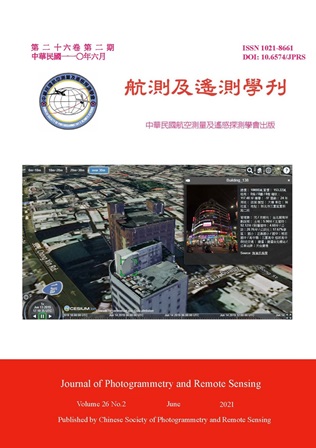
基於資料融合3D LOD2建物模型物件化之研究

Title

The Establishment of 3D LOD2 Objectivization Building Models based on Data Fusion

作者

邱式鴻、林岑燕

Author

Shih-Hong Chio, Tsen-Yann Lin

中文摘要

本研究透過整合2D 地理空間資訊、空載光達點雲、數值高程模型、空載垂直和傾斜航空影像探討大量產製3D LOD2 建物模型物件化之自動化方法。此方法程序分四個階段:(1) 根據每棟建物輪廓內的數值高程模型和光達點雲資料確定shapefile 檔案中每棟建物輪廓相對應的高程和和地面高程,並將其附加到建物輪廓shapefile 檔案中;(2) 將建物輪廓shapefile 檔案轉換為個別由三角形網格化呈現的標準檔案格式物件檔的3D LOD1 建物模型,甚至可以產製具中庭的3D LOD1 建物模型;(3) 從航空垂直和傾斜影像以及全部3D LOD1 建物模型中,確定每一棟3D LOD1 建物模型中每一個三角形面最合適的航空或傾斜影像進行紋理敷貼;(4) 每個完整的3D LOD2 建物模型均通過將其相對應的建物紋理影像進行矩行封包為單張影像並進行資料壓縮完成物件化。本研究中最後將完成之物件化模型導入WebGL 平台,展示進一步之應用。

Abstract

This paper discussed an automatic building objectivization method for generating a large number of 3D LOD2 building models by integrating 2D geospatial information, airborne LiDAR point cloud, a DEM, aerial vertical and oblique images. The procedure was divided into the following four stages. First, the elevation and ground floor elevation corresponding to each building in shapefile were determined based on LiDAR point cloud data within each building outline and a DEM, and they were appended into a building outline shapefile. Second, individual 3D LOD1 building models with the standard file format of object file presented by triangulation networks were transformed from every single building outline shapefile into the object file, and even 3D LOD1 building models with any atriums could be produced. Third, from aerial vertical and oblique images as well as whole 3D LOD1 building models, the texture corresponding to each 3D LOD1 building model triangulation was determined by the most appropriate images for texture mapping. Fourth, each complete 3D LOD2 building objectivization model was constructed by splitting and packing its corresponding building texture images into a single image for data compression. Finally, the objectivization models were imported into the WebGL platform for demonstrating the advanced application in this study.
關鍵字

資料融合、三角網、紋理敷貼、矩形包裝、三維建物模型

Keywords

Data Fusion, Triangulation Network, Texture Mapping, Rectangle Packing, 3D Building Model

附件檔名

華芸線上圖書館

https://www.airitilibrary.com/Publication/alDetailedMesh?DocID=10218661-202106-202106180004-202106180004-57-73

備註說明

N / A

Pages:

75-94

論文名稱

精化多視角影像密匹配及點雲產製

Title

Refinement of Multi-view Dense Image Matching and Point Cloud Generation

作者

劉宣萱、趙鍵哲

Author

Hsuan-Hsuan Liu, Jen-Jer Jaw

中文摘要

大量多視角影像於密匹配計算處理上較為複雜而繁瑣,且針對每一像對分別計算其初始視差值,耗損的時間成本亦相對增加;再者,具多組像對重疊條件之多視角影像,倘未善加調製其交會幾何,產製之場景點雲即便具有描述幾何多餘觀測特性,然而點位的不精確性以及較大的離散度亦無助於後續空間資訊之應用。對此,本研究提出一系列優化作業模式並區分為三大主軸:建立影像群聚關係、視差傳遞策略和點雲精化策略等。業經兩組實際資料驗證其功效及可行性,說明所研擬方法產製之點雲能有效描述場景幾何,且於兩測試區域之像對計算總量部分,減少約為44%及14%,而針對其時效提升部分則達80%以上。

Abstract

Processing large number of multi-view images is complicated and tedious. Also, when matching multiple stereo pairs, it would take long in getting disparity values if each pair is to be processed independently. In addition, redundantly described scene models with low reliability trouble the exploitation of geospatial information. This paper proposes an effective matching strategy featuring in key view selection and clustering, disparity delivery and point cloud refinement to tackle the aforementioned shortcomings. The proposed approach has been tested by two practical data sets and it is proven that both the efficient image manipulation with the computational time reduction more than 80% and quality point cloud generation well depicting the scene geometry highlight the merit of this study.

關鍵字

影像密匹配、多視角、點雲、精化

Keywords

Dense Image Matching, Multi-view, Point Cloud, Refinement

附件檔名

華芸線上圖書館

https://www.airitilibrary.com/Publication/alDetailedMesh?DocID=10218661-202106-202106180004-202106180004-75-94

備註說明

N / A

Pages:

95-115

論文名稱

地面雷射掃描儀混合模式校正系統及系統性誤差分析

Title

Hybrid Calibration System and Systematic Error Analysis for Terrestrial Laser Scanners

作者

林烜生、曾義星

Author

Hsuan-Sheng Lin, Yi-Hsing Tseng

中文摘要

為了更合理地描述地面雷射掃描儀系統性誤差,本研究提出自率定法結合個別組件校正的混合模式校正理論,共採用FARO S350、Trimble SX10與RIEGL VZ-400進行測試。根據t-test (95%信心區間) 結果,使用系統性誤差改正參數的確能有效描述儀器系統性誤差模式,其中常數項與線性項改正參數已足以描述本研究三款掃描儀的系統性誤差模式,而帶入個別組件校正得到的參數更能達到約制的效果,呈現本研究提出之理論具有更謹慎地進行地面雷射掃描儀校正與評估系統性誤差分析的潛力。

Abstract

To describe the systematic error of the Terrestrial Laser Scanners (TLS) more reasonably, based on the self-calibration method, a hybrid calibration theory that combines self-calibration and individual component calibration is proposed. In this study, FARO S350, Trimble SX10 and RIEGL VZ-400 were used to test at the National Land Surveying Center (NLSC). According to the results of t-test (in the 95% confidence interval), using systematic error calibration parameters can effectively simulate the TLS systemic error model. The results also show that the constant and linear calibration parameters are sufficient to describe the systematic errors of the three scanners used in this study, and the calibration parameters obtained from the individual component calibration can achieve a reduced effect. These show that the theory proposed in this study have the potential for more careful analysis of TLS calibration and evaluation of systematic errors.

關鍵字

地面雷射掃描儀、地面光達、校正、系統性誤差

Keywords

Terrestrial Laser Scanner, Ground-based LiDAR, Calibration, Systematic Error

附件檔名

華芸線上圖書館

https://www.airitilibrary.com/Publication/alDetailedMesh?DocID=10218661-202106-202106180004-202106180004-95-115

備註說明

N / A

Pages:

117-126

論文名稱

應用影像建模建立地下管線數位資料

Title

Application of Image-based Modeling to Establish Digital Data of Underground Pipelines

作者

李宗祐、楊明德

Author

Tzung-You Lee, Ming-Der Yang

中文摘要

地下管線資料管理流程分為外業資料取得及內業資料處理,傳統方式於外業會於現地繪製施工現場竣工圖,資料較片面零碎。利用攝影測量技術建立三維模型,可紀錄現地鉅細靡遺資訊且可獨立完成。內業資料處理需要大量人力進行資料輸入並反覆檢核,以避免造成資料錯誤。本文採用python/GDAL開發一套數位管線資料建置流程,利用一般攝影器材獲得影像並建立三維模型,於模型中進行數化及屬性資料建置,依使用者選定之設施物類別自動建立相對應欄位並自動檢核,包含基本輸入規則及邏輯性檢核,輔助改善管線資料管理方式,僅需1或2人即可完成,可達省時、省工之數位化地下管線管理流程。

Abstract

The data management process of underground pipeline is divided into field data acquisition and data processing. Traditionally, the engineers at the construction site make on-site as-built drawings of the construction, and the built data is fragmented. The use of photogrammetry technology to create a three-dimensional model can record the details of the construction site more completely and independently. In-house data processing requires a lot of manpower for data input and repeated checks to avoid data errors. This paper uses python/GDAL to develop a set of digital pipeline data construction process through general photographic equipment to obtain images to build a three-dimensional model, digitizes and builds attribute data in the model, and automatically creates a correspondence according to the type of facility selected by the user. The field data can be automatically checked, including basic input rules and logical checks, to assist in improving the pipeline data management. Only one or two engineers are needed to complete the work so to achieve a time-saving and labor-saving digital underground pipeline management process.

關鍵字

影像建模、運動結構回復、地下管線資料

Keywords

Image-based Modeling, Structure from Motion, Underground Pipeline Data

附件檔名

華芸線上圖書館

https://www.airitilibrary.com/Publication/alDetailedMesh?DocID=10218661-202106-202106180004-202106180004-117-126

備註說明

N / A

更多活動學刊