26卷/4期

26卷/4期

華藝線上圖書館

Pages:

193-207

論文名稱

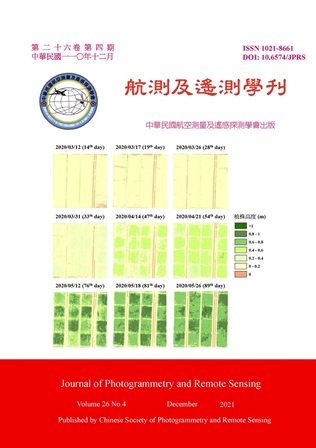
多時期無人機影像於稻作植株高度量測之應用

Title

Application of Multi-Date UAV Images to Measurement of Rice Height

作者

楊明德、陳柏安、陳怡璇、張巧琳、賴明信

Author

Ming-Der Yang, Bo-An Chen, Yi-Hsuan Chen, Chiau-Lin Chang, Ming-Hsing Lai

中文摘要

稻作為世界重要糧食,尤其在亞洲地區。稻作高度是一重要生長性狀,施肥過多使植株生長過高易導致倒伏,施肥過少植株過矮則影響稻作的產量。實務上農務決策皆以經驗判斷,傳統學術調查使用木尺量測稻作高度。隨著無人飛行載具 (Unmanned Aerial Vehicle, UAV) 的普及與技術的進步,專家得以使用遙測方法大面積調查農藝性狀。本研究為了使用UAV監測各肥分等級之稻作在各生長階段的高度變化,除了制定UAV稻作監測飛行條件外,亦比較K-means分群法 (K-means Clustering, or Lloyd–Forgy algorithm)與百高平均法獲取各樣區稻作代表高度,並追蹤各生長階段的植株高度變化,以供耕作決策參考。藉由空拍影像分析判釋調查水稻植株高度之變化,未來可建立智慧化生產與風險管理預測,擬定各生育期建議之栽培管理與應對方針。

Abstract

Rice is one of the major crops in the world, especially in Asia. The height of rice is an important feature of growth health. Over-fertilization makes plants grow too high so to tend to rice lodging, while less-fertilization makes plants too short so to yield incompletely. In practice, panicle fertilization decision making is judged by experience. Traditionally academic survey of rice height uses wooden rulers to measure the rice height in the field. With the popularization of Unmanned Aerial Vehicles (UAV) and the advancement of technology, experts have been able to use remote sensing methods to investigate agricultural heterogeneous traits on a large scale. This study uses UAV to measure the height variation of rice for various levels of fertilization at different growth stages. This study also formulating UAV flight procedure of rice monitoring. Top 100 height average and K-means clustering (or Lloyd–Forgy algorithm) were executed and compared for the measurement of rice height in a paddy. The variation of rice height can be monitored as a reference for cultivation decision, smart yield, and risk management.

關鍵字

無人機、數值地表模型、精準農業、K-means分群法

Keywords

Unmanned Aerial Vehicle, Digital Surface Model, Precision Agriculture, K-means Clustering

附件檔名

華芸線上圖書館

https://www.airitilibrary.com/Publication/alDetailedMesh?DocID=10218661-202112-202201040011-202201040011-193-207

備註說明

N / A

Pages:

209-220

論文名稱

應用深度學習於航照正射影像之房屋偵測

Title

Building Detection from Aerial Orthoimage Using Deep Learning Technology

作者

張智安、傅于洳

Author

Tee-Ann Teo, Yu-Ju Fu

中文摘要

為提升判識房屋偵測效率,本研究以深度學習技術建立智慧辨識方法,使用臺灣通用電子地圖搭配航照正射影像建立訓練資料集,萃取影像中房屋區域並偵測前後期房屋變遷區域。研究策略先偵測前後期房屋區域,再利用前後期房屋區域進行變遷分析。分析房屋區域偵測成果,影像中房屋高差移位會增加誤授的比例,智慧辨識的房屋面積大於臺灣通用電子地圖的房屋範圍,房屋偵測成果之準確率約74%,召回率達90%。比較使用不同年度或範圍之訓練與預測資料後,發現利用前期圖資作為深度學習模型的訓練資料,預測相同範圍之後期房屋區域,有較佳的偵測精度。

Abstract

Building model is an essential element in a topographic map. In order to improve the automation of building extraction, this research uses deep learning technology to identify building regions and changed areas from multi-temporal aerial orthoimage. The building polygons from Taiwan e-Map and corresponding aerial orthoimage are combined to generate the training dataset for deep learning. The building regions are automatically predicted by multispectral orthoimage using convolutional neural network. Then, the change detection compares bi-temporal building regions from deep learning in two seasons. The experimental results indicated that the F1-score and recall in building detection were 74% and 90%, respectively. The error is mainly caused by the relief displacement of building. Moreover, the accuracy of change detection is mainly related to the size of building area.

關鍵字

房屋偵測、變遷分析、深度學習、語意分割

Keywords

Building Detection, Change Detection, Deep Learning, Semantic Segmentation

附件檔名

華芸線上圖書館

https://www.airitilibrary.com/Publication/alDetailedMesh?DocID=10218661-202112-202201040011-202201040011-209-220

備註說明

N / A

Pages:

221-227

論文名稱

三維動態展示於室內空間設計之技術應用-以SketchUp動態元件為例

Title

Application of Dynamic 3D Animation to Interior Design - A Case of SketchUp Dynamic Components

作者

施沛鴻、楊明德

Author

Pei-Hung Shih, Ming-Der Yang

中文摘要

本文探討三維動態展示類別,驗證三維空間模擬在導入動態展示後,如何提升設計者與使用者之間的溝通效率。本文採用SketchUp為製作平台,並輔以三維動態元件功能來呈現。本文將SketchUp動態元件製作方法,歸納整理成基礎之五大行為,包括:材質更替、比例縮放、物件隱藏、互動點擊與陣列複製。並以實務案例進行模擬,以讓模擬結果與真實物理環境相同,協助設計師直接應用於自身工作案例,減少學習與摸索之時間。未來三維動態展示將朝著結合移動裝置及雲端模擬趨勢發展,並配合虛擬實境,透過動態感應裝置與使用者互動,並進一步進行模型的三維尺寸與材質的修改,達成數位分身的應用。

Abstract

All simulations in the study were conducted in SketchUp, and were demonstrated using SketchUp Dynamic Components. In order to improve design workflow, this study focuses on five basic elements (behaviors): (1) material, (2) scale, (3) hidden, (4) on-Click, and (5) copy. Designers will be benefited by this study in time-saving when applying dynamic 3D animation. In the future, dynamic 3D animation will combine mobile devices and cloud simulation, and in conjunction with virtual reality can interact with users to further carry out the modification on the size and material of 3D models as a digital avatar.

關鍵字

室內設計、電腦輔助設計、三維動態展示、SketchUp動態元件

Keywords

Interior Design, CAD, Dynamic 3D Animation, SketchUp, Dynamic Component

附件檔名

華芸線上圖書館

https://www.airitilibrary.com/Publication/alDetailedMesh?DocID=10218661-202112-202201040011-202201040011-221-227

備註說明

N / A

Pages:

229-246

論文名稱

利用衛星影像及監測數據分析高屏溪揚塵災害與潛在發生區位

Title

Analysis of Aeolian Dust Disasters and Potential Areas of Aeolian Dust Occurrence of Gaoping River with Satellite Images and Monitoring Data

作者

林彥儀、林宇家、洪子棋、林佳慧

Author

Yen-Yi Lin, Yu-Chia Lin, Tzu-Chi Hung, Chia-Hui Lin

中文摘要

本文嘗試探索高屏溪揚塵災害之原因及來源。我們蒐集風速、風向與PM10資料,繪製2012年以來三場揚塵災害的風花圖與PM10分布圖,發現高屏溪揚塵主要受強烈南風揚起,具沿河向北輸送的特性。為找到揚塵來源,我們將2018~2020年三個時段的衛星影像轉成NDVI與NDWI,透過前後期顏色變化找出休耕農地、沙洲與高低灘地。我們也利用QGIS-SCP將衛星影像做監督式分類,轉成向量模式後進行跨年度疊圖,發現研究區北段的二重溪河道沙洲,與面積大且長時間休耕的農場,揚塵潛在威脅最大。最後以衛星影像分析與實地考察結果,繪出高屏溪揚塵潛在發生區位,提供揚塵抑制規劃參考。

Abstract

This study focuses on the causes and sources of aeolian dust along the Gaoping River. First, various data, including wind speed, wind direction, and PM10, are collected to draw wind rose charts and isarithmic maps. The illustrations point out that generally, dusts are raised by south winds and later transported north along the river. Next, satellite images between 2018 and 2020 are converted to NDVI and NDWI modes with the aim of determining the sources of aeolian dust. Different colors are used to depict the special distributions of fallow farmlands, sandbars, high and low riverbanks, etc. After that, with the use of QGIS-SCP supervised image classification and its later converted vector mode, overlay analysis over the years is performed. The results suggest that wide fallow farmlands and sandbars of Erzhong River, both lying in the northern section of the research area, comprise the greatest threat of aeolian dust occurrences. Based on the analysis mentioned above as well as field investigation, this study lays out the potential areas of aeolian dust occurrence along the Gaoping River, and it is hoped to assist the future plans for suppressing aeolian dust.
關鍵字

揚塵、高屏溪、福衛五號、衛星影像分析、監測數據分析

Keywords

Aeolian dust, Gaoping River, FormoSat-5, Satellite image analysis, Monitoring data analysis

附件檔名

華芸線上圖書館

https://www.airitilibrary.com/Publication/alDetailedMesh?DocID=10218661-202112-202201040011-202201040011-229-246

備註說明

N / A

更多活動學刊